Foxshaw, building in Reigate and Banstead, Surrey, UK
Location: Reigate and Banstead
GPS coordinates: 51.27899,-0.15696
Latest update: November 25, 2023 00:30
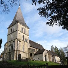
Church of St Katharine, Merstham
1.2 km
The Old Church House
1.2 km
Weighbridge Cottage
581 m
Fairdene School
1.3 km
St Nicholas Cottage
1.5 km
The Old Forge
1.5 km
Verger's Cottage
1.1 km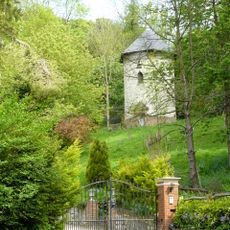
Dovecot In Grounds To North Of Wellhead
1.1 km
Hoath Farm House
509 m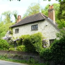
Wellhead
1.1 km
Alderstead Farmhouse
1.3 km
Barn 60 Yards North East Of Dean Farm
838 m
Earthworks of Surrey Iron Railway
151 m
Walls And Gate Piers To South East Of Priors' Mead
1.4 km
Alderstead Fort
960 m
Dean Farm
812 m
Site of manor house in Netherne Wood
1.2 km
Granary To North Of Alderstead Farmhouse
1.3 km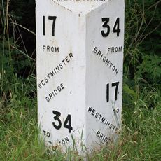
Milepost, Merstham, London Road North, opp. Harpsoar Lane; opp. Harps Oak Lane
432 m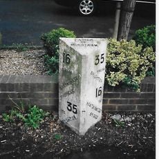
Milepost, Brighton Road, Merstham, 150m N jcn Church Lane
1.3 km
Former Stables And Forge, Joliffe Yard
832 m
Barn 5 Yards North East Of Fairdene School
1.3 km
Ruffetts Cottage
1.2 km
Barn To North East Of Hoath Farmhouse
479 m
Priors' Mead
1.4 km
Stable South Of Barn And 100 Yards East Of Dean Farm
837 m
Harps Oak
386 m
Thatched Cottage
1.1 kmReviews
Visited this place? Tap the stars to rate it and share your experience / photos with the community! Try now! You can cancel it anytime.
Discover hidden gems everywhere you go!
From secret cafés to breathtaking viewpoints, skip the crowded tourist spots and find places that match your style. Our app makes it easy with voice search, smart filtering, route optimization, and insider tips from travelers worldwide. Download now for the complete mobile experience.

A unique approach to discovering new places❞
— Le Figaro
All the places worth exploring❞
— France Info
A tailor-made excursion in just a few clicks❞
— 20 Minutes