Park View, Grade II listed house in Middle Duntisbourne, Duntisbourne Rouse, Cotswold, Gloucestershire, UK
Location: Duntisbourne Rouse
GPS coordinates: 51.75799,-2.02216
Latest update: November 21, 2025 12:56
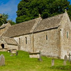
St Michael's Church, Duntisbourne Rouse
534 m
Jefferis Monument In The Churchyard Approximately 3.5M South Of Church Of St Michael
535 m
Turner's
1.5 km
Unidentified Monument In The Churchyard Approximately 4M South Of Porch To Church Of St Michael
540 m
Unidentified Monument In The Churchyard 1M West Of Jefferis Memorial To South Of Church Of St Michael
536 m
Alice's House
1.4 km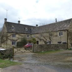
Duntisbourne Leer Farmhouse
1.4 km
Footbridge to east of ford
257 m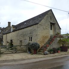
Stables to south east of Manor Farmhouse
237 m
Grove House
1.3 km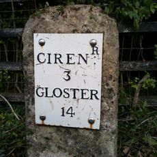
Milestone
1.3 km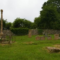
Churchyard cross in St Michael's churchyard
554 m
Barn approximately 8 metres south of Duntisbourne Leer Farmhouse
1.4 km
Cartshed and granary with attached cowhouse across road and to south east of Manor Farmhouse
229 m
Manor Farmhouse
252 m
Barn to south of Manor Farmhouse
245 m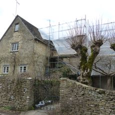
Trustams Mead
1.5 km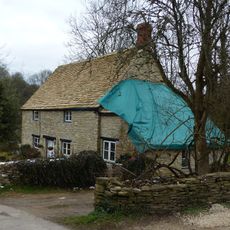
22, Duntisbourne Leer
1.4 km
Barn And Stables With Granary To South East Of Nutbeam Farmhouse
1 km
Former Granary Lightend Barn
1 km
Stables approximately 18 metres south east of Duntisbourne Leer Farmhouse
1.4 km
Pigsty approximately 20 metres north east of Duntisbourne Leer Farm
1.4 km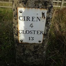
Milestone, N of Dartley farm (southbound carriageway)
941 m
Nutbeam Farmhouse
1.1 km
Old Rectory
573 m
Unidentified Monument In The Churchyard Approximately 6M South Of Tower To Church Of St Michael
538 m
Boulton Monument In The Churchyard Approximately 6M South Of Church Of St Michael
538 m
Unidentified Monument In The Churchyard Approximately 4M South Of Chancel To Church Of St Michael
534 mReviews
Visited this place? Tap the stars to rate it and share your experience / photos with the community! Try now! You can cancel it anytime.
Discover hidden gems everywhere you go!
From secret cafés to breathtaking viewpoints, skip the crowded tourist spots and find places that match your style. Our app makes it easy with voice search, smart filtering, route optimization, and insider tips from travelers worldwide. Download now for the complete mobile experience.

A unique approach to discovering new places❞
— Le Figaro
All the places worth exploring❞
— France Info
A tailor-made excursion in just a few clicks❞
— 20 Minutes