19, 21, 23, 25 And 27, High Street, building in Hurstpierpoint and Sayers Common, Mid Sussex, West Sussex, UK
Location: Hurstpierpoint and Sayers Common
GPS coordinates: 50.93417,-0.18118
Latest update: November 18, 2025 08:41
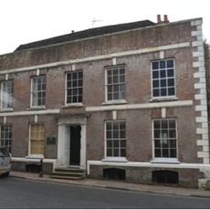
The Mansion House
312 m
The Parish Church of the Holy Trinity, Hurstpierpoint and Sayers Common
67 m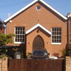
Hurstpierpoint Baptist Church
128 m
Church Green Cottages
127 m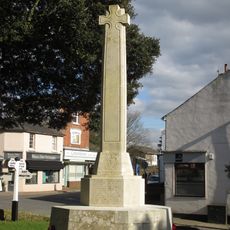
Hurstpierpoint War Memorial
111 m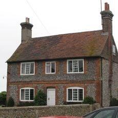
Washbrook Farmhouse
336 m
Treeps House
106 m
The Stables Behind No 8
154 m
79, High Street
284 m
131, High Street
467 m
Littlepark Farmhouse
443 m
Curds
435 m
Cowdrays
130 m
11, 13, 15 And 17, High Street
29 m
South Boundary Wall To The Mansion House, The Tower House, Orchard House And The Beeches And Including Gate House
333 m
40 And 42, High Street
171 m
Tower In The Garden Of No 74 (Tower House)
334 m
Down House
274 m
48, High Street
191 m
Bieldside Chichester House The Odd Corner
235 m
The New Inn
339 m
Garden Wall To The North West Of The Mansion House
299 m
Lamb House
134 m
Rectory Cottage
182 m
Church House
112 m
Wickham House
304 m
Greenock House
118 m
Lamb Photographics
132 mReviews
Visited this place? Tap the stars to rate it and share your experience / photos with the community! Try now! You can cancel it anytime.
Discover hidden gems everywhere you go!
From secret cafés to breathtaking viewpoints, skip the crowded tourist spots and find places that match your style. Our app makes it easy with voice search, smart filtering, route optimization, and insider tips from travelers worldwide. Download now for the complete mobile experience.

A unique approach to discovering new places❞
— Le Figaro
All the places worth exploring❞
— France Info
A tailor-made excursion in just a few clicks❞
— 20 Minutes