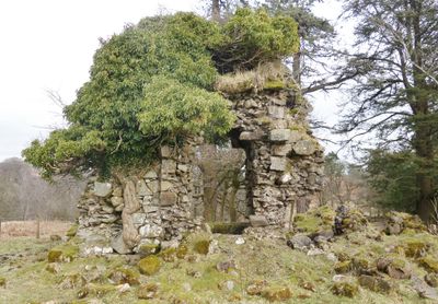
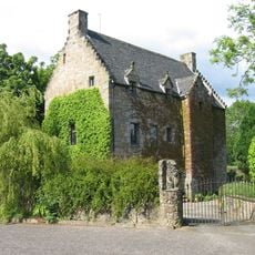
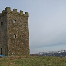
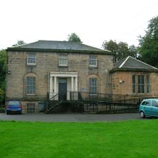
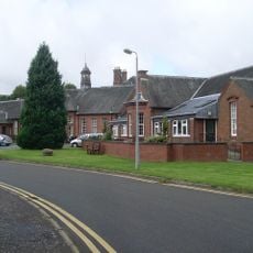
Cowden Hall, 17th century laird's house in Neilston, Scotland
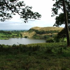
Cowden Hall is a 17th century laird's house standing in an elevated position above the Neilston Gap and overlooking Levern Water. The building displays traditional stone walls and substantial windows facing west, sitting prominently within the surrounding landscape.
The land appeared on Timothy Pont's map of Renfrewshire between 1583 and 1596 as 'Kouden', showing an earlier settlement existed here. The Spreull family held the barony until 1622 and held significant control over the important road routes connecting to Ayrshire.
The name Cowden comes from the Gaelic word 'Caltuinn', meaning hazel valley, which ties the place to Scotland's linguistic roots. This connection between the name and the natural landscape remains visible to visitors today.
The building sits in an elevated position offering clear views across the landscape, and roads connect it to the main highway running south toward Ayrshire. The location makes it easy to spot from nearby routes passing through the area.
The Spreull family incorporated tax collection symbols into their coat of arms because they controlled the major road to Ayrshire. This unusual heraldic choice reveals how road control and local power were connected in the region's past.
The community of curious travelers
AroundUs brings together thousands of curated places, local tips, and hidden gems, enriched daily by 60,000 contributors worldwide.