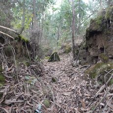
Castro de Romariz, Archaeological hillfort in Romariz, Portugal.
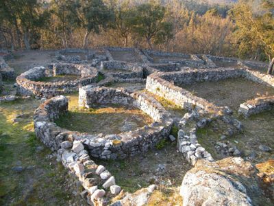
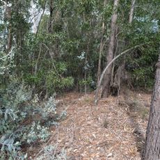
Castro de Romariz is a fortified settlement on a hilltop surrounded by multiple rings of earthen ramparts, ditches, and defensive banks that create a complex barrier system. The remains show how carefully ancient inhabitants engineered their defenses to protect the community within.
The settlement was built roughly 2,000 years ago during a period when communities in the region began moving toward larger fortified centers instead of scattered settlements. This shift reflects how populations were consolidating and organizing into more complex social structures.
The name comes from the nearby village of Romariz, and the place still shows signs of how a fortified community lived together in ancient times. Walking around the earthworks, you can sense how residents organized their settlement and defended it from their position on the hilltop.
The site is maintained as open grassland through controlled grazing, which prevents trees from growing and protects the archaeological layers underneath. Visitors should wear sturdy footwear since the terrain is uneven and paths may not be fully developed.
The multiple defensive rings demonstrate sophisticated understanding of strategic planning, showing how residents carefully engineered their layout to repel attackers at different levels. This layered approach was more advanced than what many similar settlements of the period achieved.
The community of curious travelers
AroundUs brings together thousands of curated places, local tips, and hidden gems, enriched daily by 60,000 contributors worldwide.