Thaler Weg 13, building in Tuntenhausen, Upper Bavaria, Germany
Location: Tuntenhausen
Address: Thaler Weg 13
GPS coordinates: 47.97732,11.96186
Latest update: November 23, 2025 19:25
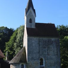
St. Georg (Thal, Tuntenhausen)
1.3 km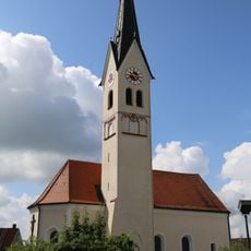
Sankt Johannes Ev.
339 m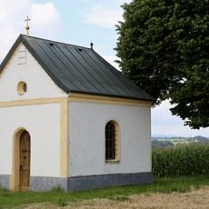
Klausenkapelle
909 m
Cultural heritage D-1-8037-0103 in Tuntenhausen
338 m
Friedhofsmauer Schloßstraße 8 in Tuntenhausen
340 m
Betonbrücke
991 m
Cultural heritage D-1-8037-0060 in Tuntenhausen
1.3 km
Cultural heritage D-1-8037-0065 in Tuntenhausen
374 m
Cultural heritage D-1-8037-0175 in Aßling
1.2 km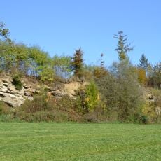
Nagelfluhwand bei Weng
1.7 km
Setzermühle 2
1.1 km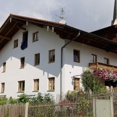
Schloßstraße 4
320 m
Schloßstraße 7 (Hohenthann, Tuntenhausen)
355 m
Bundwerk am Wirtschaftsteil
1 km
Ehemaliger Bauernhof
1.1 km
Wayside cross
690 m
Catholic church building, wayside cross, Christianity
1.4 km
Wayside cross
1.6 km
Wayside cross
849 m
Kapelle
1.1 km
Wayside cross
1.6 km
Wayside cross
1.1 km
Wayside cross
996 m
Wayside cross
1.4 km
Wayside cross
884 m
Wayside cross
919 m
Christianity, Catholic church building, wayside cross
1.4 km
Memorial, commemorative plaque
1.5 kmReviews
Visited this place? Tap the stars to rate it and share your experience / photos with the community! Try now! You can cancel it anytime.
Discover hidden gems everywhere you go!
From secret cafés to breathtaking viewpoints, skip the crowded tourist spots and find places that match your style. Our app makes it easy with voice search, smart filtering, route optimization, and insider tips from travelers worldwide. Download now for the complete mobile experience.

A unique approach to discovering new places❞
— Le Figaro
All the places worth exploring❞
— France Info
A tailor-made excursion in just a few clicks❞
— 20 Minutes