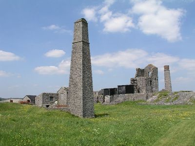
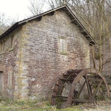
Magpie Mine, Lead mine ruins in Peak District, England.
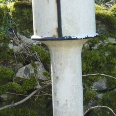
Magpie Mine is an abandoned lead mine in the Peak District with limestone buildings, a Cornish steam engine house, and multiple shafts still visible on the surface. The remains show the infrastructure miners used for extracting ore and managing water from below ground.
Mining began here in 1682 when the Shuttlebark vein was discovered and continued for nearly 300 years with periods of closure and reopening. The final cessation of work came in 1958, marking the end of lead extraction in this location.
The site reveals how 19th-century miners worked and lived through its standing buildings and equipment layout. You can observe the practical arrangement of structures that shows the daily reality of mining operations.
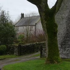
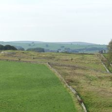
You can reach the site through footpaths from nearby Sheldon village, with multiple entry points from surrounding lanes around the ruins. Wear sturdy shoes as the ground is uneven and becomes slippery when wet.
An underground drainage system still pumps millions of gallons of water daily from deep below into the nearby River Wye, even though mining stopped over 60 years ago. This network demonstrates the scale of water management that miners had to tackle during operations.
Location: Ashford in the Water
GPS coordinates: 53.20980,-1.74302
Latest update: December 8, 2025 19:48
Ashford Black Marble
2.5 km
Church of Holy Trinity
2.7 km
St Michael and All Angels' Church, Sheldon
829 m
Church of St Leonard
2.7 km
Well to north of Riverside Hotel
2.6 km
Quaker Chapel
2.7 km
The Bull's Head Public House
2.7 km
Riverside Hotel
2.6 km
Ashford Bobbin Mill, West Building
1.8 km
Dovecote and attached wall to east of Riverside Hotel
2.6 km
Bridge to north of Ashford Bobbin Mill
1.9 km
Ashford Bobbin Mill, East Building
1.8 km
Sheldon House
2.6 km
Sheepwash Bridge
2.6 km
Bridge at The Rookery
2.5 km
The Rookery
2.5 km
Village Cross
2.7 km
Coach house and stables east of The Rookery
2.5 km
Gate piers and attached walls to east of Riverside Hotel
2.7 km
Holme Deene
700 m
Green Cowden Farmhouse
2.3 km
Haddon Grove Farm (East)
2.2 km
Taddington Field Farmhouse
2.7 km
The Elms
2.7 km
Milepost At Os 169 707
2.6 km
Townend Farmhouse
2.6 km
True Blue nucleated lead mine, 600m ESE of Magpie Mine
553 m
Bole Hill bowl barrow
1.1 kmVisited this place? Tap the stars to rate it and share your experience / photos with the community! Try now! You can cancel it anytime.
Discover hidden gems everywhere you go!
From secret cafés to breathtaking viewpoints, skip the crowded tourist spots and find places that match your style. Our app makes it easy with voice search, smart filtering, route optimization, and insider tips from travelers worldwide. Download now for the complete mobile experience.
A unique approach to discovering new places❞
— Le Figaro
All the places worth exploring❞
— France Info
A tailor-made excursion in just a few clicks❞
— 20 Minutes