Tankerton Slopes, Protected natural area in Whitstable, United Kingdom
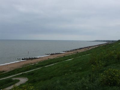
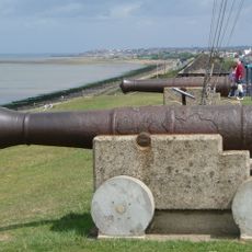
Tankerton Slopes is a protected natural area in Whitstable, Kent, where gentle slopes rise from the seaside promenade. The site hosts diverse plant life and rare herbs, bounded by a long waterfront promenade that extends toward neighboring coastal villages.
The site was designated as a protected area to safeguard its ecological value and rare species found there. This formal protection has secured its status as a conservation site and ensures ongoing care for its natural resources.
The slopes serve as a gathering place where locals and visitors relax by the seaside, with a row of colorful beach huts creating the typical English seaside charm. The lively mix of people walking, sitting, and enjoying the waterfront gives the spot its friendly character.
The site is easily accessible from the seafront promenade, which offers multiple entry points for visitors. The terrain is suitable for casual exploration by people of all abilities to enjoy the waterfront views.
At low tide, a remarkable gravel ridge known as The Street emerges and extends far into the sea, allowing visitors to walk far out into the water. This rare natural feature offers an unusual experience of walking across the seabed and seeing the landscape from a completely different vantage point.
The community of curious travelers
AroundUs brings together thousands of curated places, local tips, and hidden gems, enriched daily by 60,000 contributors worldwide.