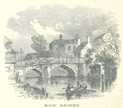
Bow Bridge, Medieval bridge in Bow, London, England.
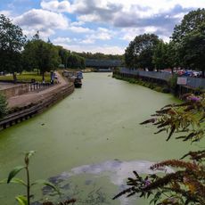
Bow Bridge is a stone crossing over the River Lea in East London that connects the districts of Bow and Stratford. The structure features multiple arched openings and was widened in 1741 to handle growing traffic between Middlesex and Essex.
The bridge was built after a notable accident in 1110 when Queen Matilda fell into the River Lea. It replaced an older ford crossing that had been used since Roman times.
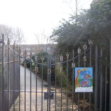
The name Bow comes from the bridge's arched design and shaped the identity of this East London area. Today, visitors can see how it anchors the local streetscape and serves as a neighborhood landmark.
Access to the bridge is free from both sides, and you can cross on foot or by bicycle. When visiting, take time to observe the stonework and arch details from different vantage points.
During the English Civil War, the bridge was the site of military confrontations in 1648 between Parliamentary and Royalist forces. This episode made it a strategically important location in local history.
GPS coordinates: 51.52971,-0.01362
Latest update: December 12, 2025 09:05
Kingsley Hall
349 m
Bow Church
253 m
House Mill
473 m
Former Poplar Town Hall
465 m
Rose and Crown
372 m
Three Mills Residential Moorings
445 m
Grove Hall Park
303 m
Church of Our Lady and St Catherine of Siena, Bow
334 m
Bob's Park
335 m
House Mill
474 m
116 Bow Road and area railings
426 m
Statue of William Ewart Gladstone
329 m
Bow Bus Garage
462 m
Gentlemen's Public Convenience At Bromley-By-Bow Adjacent To Statue Of WE Gladstone
331 m
Drapers Almshouses And Chapel
492 m
Iron Railings, Gates And Gate Piers To Churchyard Of St Mary's Church
191 m
Monument To Joseph Dawson In The Churchyard Of St Mary Bow
319 m
Bryant and May War Memorial
289 m
How Memorial Gateway
152 m
163, Bow Road E3
391 m
223, Bow Road E3
174 m
Bromley Public Hall
450 m
10 and 12, Stroudley Walk
378 m
199, Bow Road E3
250 m
Paved Roadway Extending From West Side Of House Mill To Wall And Gate On East Side Of Clock Mill
500 m
The Children's House (Nursery School)
466 m
2-22, Fairfield Road E3
432 m
2 Bollards (Between Statue Of We Gladstone And St Mary's Churchyard Entrance
324 mVisited this place? Tap the stars to rate it and share your experience / photos with the community! Try now! You can cancel it anytime.
Discover hidden gems everywhere you go!
From secret cafés to breathtaking viewpoints, skip the crowded tourist spots and find places that match your style. Our app makes it easy with voice search, smart filtering, route optimization, and insider tips from travelers worldwide. Download now for the complete mobile experience.
A unique approach to discovering new places❞
— Le Figaro
All the places worth exploring❞
— France Info
A tailor-made excursion in just a few clicks❞
— 20 Minutes