St Anselm's Church, Pembury, Catholic church in Pembury, England
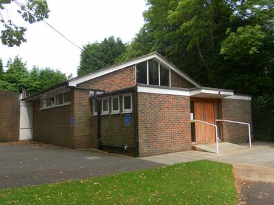
St Anselm's Church is a Catholic place of worship in Pembury designed with a contemporary approach that includes a main prayer hall and a permanent altar. The Stations of the Cross line the walls, creating focal points throughout the interior space.
The church began in 1964 as a small chapel and gained new standing in 2011 when it acquired quasi-parish status. This change reflected its growing role within the broader Catholic community.
The congregation includes former Anglican worshippers from St Barnabas Church in Royal Tunbridge Wells who converted to Catholicism together with their vicar. This shared background shapes the community's identity and how people gather here.
The church sits on Lower Green Road in a convenient location within the town. A traditional lychgate at the entrance clearly marks where the church grounds begin.
The lychgate marking the entrance is an unusual architectural touch that separates the sacred space from the community area around it. This traditional gateway style was once common at English parish churches before falling out of use.
Location: Pembury
Website: http://saintanselms.org.uk
GPS coordinates: 51.14408,0.32264
Latest update: December 14, 2025 18:13
Matfield House
3.4 km
Chapel Of Ease Of St Luke
2.8 km
Old Church of St Peter
2.1 km
Church of St James
3.6 km
The Star Public House
3.5 km
The Blue Boys Inn
2.3 km
Upper Church of St Peter
234 m
The Camden Arms
166 m
Fairthorne House
2.5 km
Colebrook Viaduct
3.6 km
Matfield War Memorial
2.8 km
Pulhamite Rockery, Dunorlan Park
2.7 km
The Lodge
54 m
Grecian Temple, Dunorlan Park
2.7 km
Little Hawkwell Farmhouse
2.5 km
Downingbury Farmhouse
1.4 km
Downingbury Farm Barn
1.5 km
Terrace Wall And Steps Of Dunorlan To The South East Of The Former Dunorlan House
2.8 km
The Almshouses
149 m
Pulhamite And Terracotta Fountain, Dunorlan Park
2.7 km
Pulhamite Cascade, Stepping Stones And Bridge In Water Garden, Dunorlan Park
2.7 km
Hatherliegh Including Garden Walls And Gate To The East
3.3 km
Packs In The Wood
3.2 km
Anonymous Chest Tomb Approximately 1.5 Metres South Of The Nave Of The Old Church Of St Peter
2.1 km
Poppingbury
491 m
Foxella
2.5 km
Sandhill Farmhouse
1.7 km
Milestone, High Street, opp. Cornford Lane, E of Woodsgate Way
581 mVisited this place? Tap the stars to rate it and share your experience / photos with the community! Try now! You can cancel it anytime.
Discover hidden gems everywhere you go!
From secret cafés to breathtaking viewpoints, skip the crowded tourist spots and find places that match your style. Our app makes it easy with voice search, smart filtering, route optimization, and insider tips from travelers worldwide. Download now for the complete mobile experience.
A unique approach to discovering new places❞
— Le Figaro
All the places worth exploring❞
— France Info
A tailor-made excursion in just a few clicks❞
— 20 Minutes