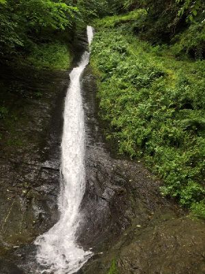
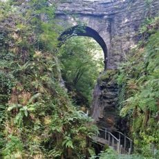
White Lady Waterfall, 30-meter waterfall in Lydford Gorge, Devon, England
White Lady Waterfall is a 30-meter cascade in Lydford Gorge, Devon, plunging over a vertical limestone cliff face into the River Lyd. Water creates a white spray pattern against the dark rock as it falls.
The waterfall and surrounding gorge attracted many Victorian travelers who documented its natural features through paintings and written accounts. This artistic attention made it a notable destination for nature enthusiasts of the 1800s.
The name comes from local stories about a ghostly woman in white who appears near the falls on moonlit nights. This legend shapes how visitors experience and talk about the place.
The site is best reached on foot via trails that start from Lydford and lead into the gorge. Paths can be slippery, especially after rain, so sturdy footwear is advisable.
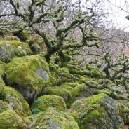
The waterfall sits within a temperate rainforest, a rare ecosystem in Britain that supports specialized mosses and ferns. These moisture-loving plants thrive thanks to the constant damp and mist in the gorge.
The community of curious travelers
AroundUs brings together thousands of curated places, local tips, and hidden gems, enriched daily by 60,000 contributors worldwide.