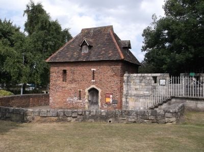
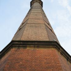
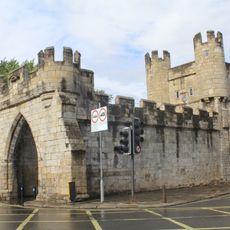
The Red Tower, York, Medieval tower near Foss Islands Road in York, England.
The Red Tower is the sole brick structure within York's medieval city walls, constructed around 1490 with distinctive red masonry. It once marked the southern boundary where the fortifications met the King's Fishpool, serving as a key point along the defensive perimeter.
The tower was built around 1490 during efforts to reinforce York's city defenses under Richard III and Henry VII. Its construction became entangled with tensions between the craft guilds that controlled the city's trades.
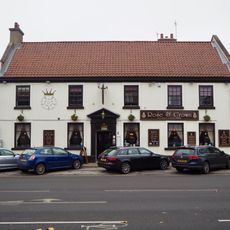
The tower reflects the power of the craft guilds that shaped York, with the building itself serving as a marker of their influence in the medieval city. Local people still gather here, continuing a tradition of community use that spans centuries.
The location is easily reached via Foss Islands Road and provides access to the city walls in the surrounding area. The ground floor operates as a community cafe, making it a convenient stop to rest or refresh during a walk along the fortifications.
The tower's stone foundations remain buried beneath the ground because ground levels shifted when the King's Fishpond was filled in to create modern Foss Islands Road. These hidden bases form an important part of the original structure, though they are no longer visible to visitors.
Location: City of York
Part of: City Wall From The Red Tower To Fishergate Postern Tower Fishergate Bar Fishergate Postern Tower The Red Tower Walmgate Bar
GPS coordinates: 53.95798,-1.07137
Latest update: December 14, 2025 13:03
St Denys's Church, York
347 m
Church of St Margaret
173 m
Bowes Morrell House
261 m
77, Walmgate
266 m
Former Maxwells Hotel (Numbers 50, 52 and 54); 50-58, Walmgate
314 m
The Spread Eagle Public House
235 m
The Waggon And Horses Public House (Number 19)
365 m
Rose And Crown Public House
347 m
Chimney at Works And Services Depot of York City Council
260 m
26 and 28, Walmgate
364 m
Former brewery warehouse approximately 5 metres north west of number 18 George Street (not included)
359 m
Entrance Gates At Stamford House And George House
352 m
32, Walmgate
354 m
68 and 70, Walmgate
287 m
35 And 37, Walmgate
345 m
29 And 31, George Street
364 m
Walmgate Bar
314 m
65, 67, 69 And 69A, Walmgate
277 m
114, Walmgate
234 m
1 and 3, George Street
288 m
15-27, George Street
352 m
9, 11 and 13, George Street
317 m
Gate Approximately 100 Metres South West Of St Margarets Church
237 m
75, Walmgate
271 m
73, Walmgate
275 m
Rowntree Wharf
229 m
64 and 66, Walmgate
294 m
34, Walmgate
349 mVisited this place? Tap the stars to rate it and share your experience / photos with the community! Try now! You can cancel it anytime.
Discover hidden gems everywhere you go!
From secret cafés to breathtaking viewpoints, skip the crowded tourist spots and find places that match your style. Our app makes it easy with voice search, smart filtering, route optimization, and insider tips from travelers worldwide. Download now for the complete mobile experience.
A unique approach to discovering new places❞
— Le Figaro
All the places worth exploring❞
— France Info
A tailor-made excursion in just a few clicks❞
— 20 Minutes