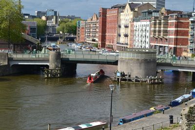
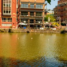
Redcliffe Bridge, Bristol, Road bridge in central Bristol, England
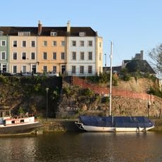
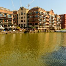
Redcliffe Bridge is a road crossing over the Floating Harbour in central Bristol with a movable central section for vessels to pass underneath. The lifting mechanism raises the middle span to allow tall ships through while serving pedestrians and vehicles on this key route across the water.
The bridge opened in 1938 and was rebuilt in 1942 following damage from wartime bombing. This reconstruction reflects how the city's infrastructure recovered during the post-war years.
The bridge links the Redcliffe district to the city center and forms part of the everyday landscape that connects different parts of Bristol.
The bridge is open daily to pedestrians and vehicles under normal conditions and is straightforward to cross. Occasional maintenance on the lifting mechanism may cause temporary interruptions to traffic flow.
The lifting mechanism remained in a fixed position for many years until January 2021, when it performed a rare raising operation. This unusual event reminded people of the bridge's original function that had long been dormant.
Location: Bristol
GPS coordinates: 51.44953,-2.59194
Latest update: December 13, 2025 17:10
St Mary Redcliffe
205 m
Bristol Ferry Boats
87 m
Redcliffe Shot Tower
165 m
Equestrian statue of William III
220 m
Queen Square House, Bristol
111 m
61 Queen Charlotte Street, Bristol
205 m
Sailors Refuge, Bristol
136 m
12, Welsh Back, Bristol
109 m
The Ostrich Inn
227 m
War Memorial, St Mary Redcliffe
212 m
57, Queen Charlotte Street
218 m
Redcliffe Wharf Quays And Bollards, Extending Approximately 250 Metres South Of Redcliffe Bridge
101 m
55, Queen Charlotte Street
223 m
17 And 18, Queen Square
129 m
Balustrade, Wall And Well Head 5 Metres West Of Church Of St Mary Redcliffe
180 m
WCA Warehouse
83 m
Hermitage in Quaker burial ground near St Mary Redcliffe
130 m
Hand Crane On Redcliffe Wharf
150 m
27 And 28, Queen Square
124 m
The Grove Wharf Extending Approximately 200 Metres Between Redcliffe Bridge And Mud Dock
172 m
Numbers 3-13 And Attached Front Area Railings And Gates
175 m
10 and 12, Queen Square
186 m
Severn Shed
83 m
22, 23 And 24, Queen Square
104 m
59, Queen Charlotte Street
215 m
Former Yeo Valley Farms Warehouse
126 m
Numbers 2 To 12 And Attached Front Area Railings
147 m
Buchanans Wharf
199 mVisited this place? Tap the stars to rate it and share your experience / photos with the community! Try now! You can cancel it anytime.
Discover hidden gems everywhere you go!
From secret cafés to breathtaking viewpoints, skip the crowded tourist spots and find places that match your style. Our app makes it easy with voice search, smart filtering, route optimization, and insider tips from travelers worldwide. Download now for the complete mobile experience.
A unique approach to discovering new places❞
— Le Figaro
All the places worth exploring❞
— France Info
A tailor-made excursion in just a few clicks❞
— 20 Minutes