Yatesbury House Farmhouse, farmhouse in Cherhill, Wiltshire, UK
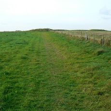
Windmill Hill
2.1 km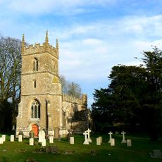
Church of All Saints
525 m
Saucer barrow 250m east of Windmill Hill: part of the Windmill Hill round barrow cemetery
2.3 km
Pair of round barrows 200m SSE of Windmill Hill: part of the Windmill Hill round barrow cemetery.
2.1 km
A causewayed enclosure, the core of a round barrow cemetery, part of a prehistoric field system and an associated mortuary enclo
1.8 km
Bowl barrow 200m south of Windmill Hill: part of the Windmill Hill round barrow cemetery.
1.9 km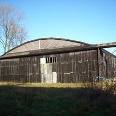
Two Former Hangars On North Side Of Former Airfield
1.6 km
Bowl barrow 230m west of The Grange, Beckhampton
2.6 km
The Manor House
537 m
Cross dyke 520m north east of Cherhill Monument
2.5 km
Tudor Thatch
278 m
Nolands Farmhouse
1.4 km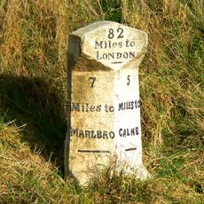
Milestone Approximately 0.75 Miles West Of The Beckhampton Roundabout
2.4 km
Bowl barrow 350m north-east of White Horse Plantation
2.1 km
Pair of bowl barrows on West Down, 550m east of Witch Plantation
2.5 km
Horslip long barrow, 450m north-west of Horslip Bridge.
2 km
Bowl barrow 200m east of Windmill Hill: part of the Windmill Hill round barrow cemetery.
2.2 km
Pair of round barrows and section of linear earthwork NE of the gallops on West Down
2.3 km
Bowl barrow 190m north east of Nolands Farm, Yatesbury
1.2 km
Former Hangar At North East Corner Of Former Airfield
1.2 km
Two bowl barrows 320m south-east of Little London
545 m
Bowl barrow 750m south-west of Manor Farm: part of the Windmill Hill round barrow cemetery
2.4 km
Combined Officers Mess And Offices, Yatesbury Airfield
1.8 km
Bowl barrow 400m west of Cooks Plantation
1.9 km
Linear boundary earthwork and associated field system on Cherhill Down
2 km
The Old Rectory
1 km
Granary At Manor Farm
494 m
Manor House
424 mReviews
Visited this place? Tap the stars to rate it and share your experience / photos with the community! Try now! You can cancel it anytime.
Discover hidden gems everywhere you go!
From secret cafés to breathtaking viewpoints, skip the crowded tourist spots and find places that match your style. Our app makes it easy with voice search, smart filtering, route optimization, and insider tips from travelers worldwide. Download now for the complete mobile experience.

A unique approach to discovering new places❞
— Le Figaro
All the places worth exploring❞
— France Info
A tailor-made excursion in just a few clicks❞
— 20 Minutes