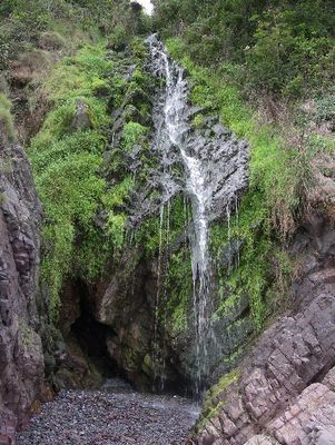
Clovelly Waterfall, Coastal waterfall in Clovelly, England.
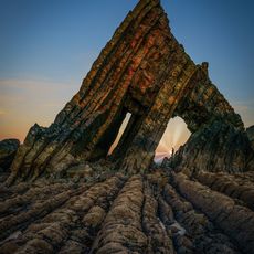
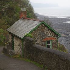
Clovelly Waterfall is a coastal cascade flowing down steep cliffs into a rocky cove on the North Devon shore. The water descends through multiple tiers before reaching the pebbly beach, where it filters into the stones rather than pooling.
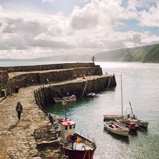
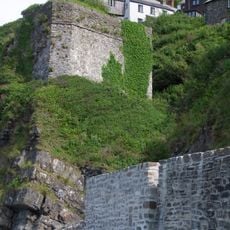
The waterfall sits near caves that served smugglers during the 18th century, when Clovelly functioned as a strategic maritime hub. The area's remote coves and rocky terrain made it ideal for concealing contraband during that era of coastal trading.
Local fishermen traditionally used the waterfall's location as a navigation marker when returning to Clovelly's harbor after their maritime expeditions.
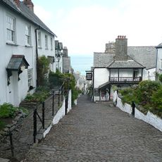
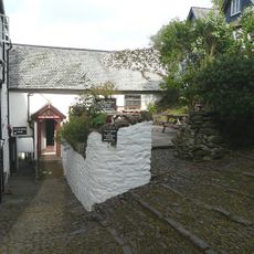
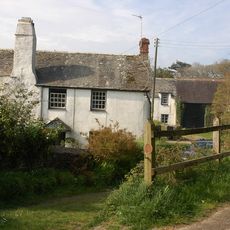
Getting there requires walking downhill through the village on steep stone streets, then scrambling over large pebbles to reach the water's edge. Sturdy footwear is essential, and you should allow plenty of time for the climb back up.
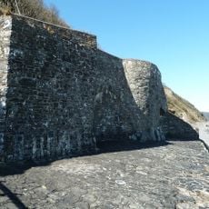
The water stream vanishes into the beach pebbles rather than pooling at the base, creating an unusual natural phenomenon. This happens because the permeable shingle absorbs the flow rapidly before it can collect.
Location: Clovelly
GPS coordinates: 50.99624,-4.39488
Latest update: December 6, 2025 19:07
Devon combines historical sites and natural landscapes across a region in southwest England. The area extends from moorlands in Dartmoor National Park to cliffs along the Bristol Channel and English Channel coasts. Visitors find Norman castle ruins like Totnes Castle and Okehampton Castle, Georgian...
Hartland Abbey
8 km
Portledge Manor
7.4 km
Clovelly Court
1.2 km
Clovelly Lifeboat Station
299 m
The Red Lion Hotel
367 m
Anchor Inn
6 km
Church of All Saints
1.2 km
Church of All Hallows
3.7 km
Church of St James
7.5 km
Church of St Anne
3.2 km
Chapel Of St John
6.1 km
The New Inn Hotel
375 m
Memorial To Queen Victoria Adjacent To No 6
410 m
Methodist Chapel Behind The New Inn
361 m
Church House
8.4 km
Hart Inn
6.1 km
Hoops Inn
5.6 km
Blackchurch Rock
3 km
Manners Memorial Cross and Peace Park Stone Plaque
500 m
Forest Gardens
3.9 km
The Cabin
3.6 km
Clovelly Pier
352 m
Lime Kiln To West Of Beach Access
3.4 km
Emilys
3.8 km
Higher Brownsham Farmhouse And Barn Adjoining To North-west
3.7 km
Lime Kiln To East Of Beach Access With Access Ramp
3.6 km
K6 Telephone Kiosk
3.6 km
The Angels Wings
1.6 kmVisited this place? Tap the stars to rate it and share your experience / photos with the community! Try now! You can cancel it anytime.
Discover hidden gems everywhere you go!
From secret cafés to breathtaking viewpoints, skip the crowded tourist spots and find places that match your style. Our app makes it easy with voice search, smart filtering, route optimization, and insider tips from travelers worldwide. Download now for the complete mobile experience.
A unique approach to discovering new places❞
— Le Figaro
All the places worth exploring❞
— France Info
A tailor-made excursion in just a few clicks❞
— 20 Minutes