Horner's Neck Wood

Log in to your account

AroundUs is a community-driven map of interesting places, built by curious explorers like you. It grows with every review, story, and photo you share.
Connect to save your favorite spots, contribute locations, and create personalized routes.
Continue with Google
Continue with Apple
Continue with X
Continue with Facebook
Continue with email
By continuing, you accept our Terms and Conditions and our Privacy Policy
Create an account

Horner's Neck Wood

Add to collection
Map
Suggest a change
Share

Horner's Neck Wood, Forest in Brendon and Countisbury, United Kingdom.

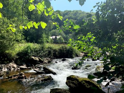
Horner's Neck Wood is a forested area in Brendon and Countisbury spread across steep slopes within Exmoor National Park. Dense oak woodlands and moss-covered ground shape the landscape around the East Lyn River.

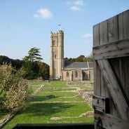
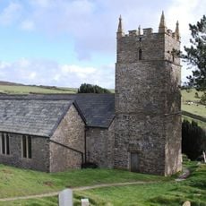
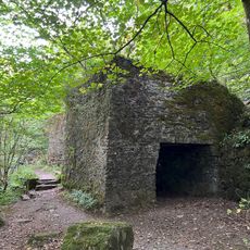
The woodland sits near an Iron Age fort at Countisbury, marking where ancient settlements once flourished in this part of North Devon. Historic packhorse routes run through the landscape, showing how goods moved across these hills centuries ago.

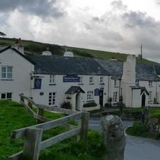
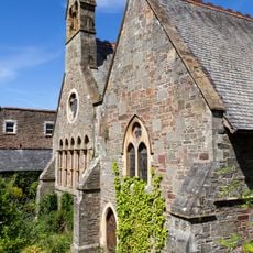
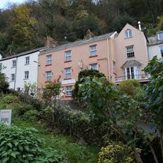
Local residents maintain traditional Devon agricultural practices around the woodland, with stone buildings and historical packhorse tracks defining the rural character.

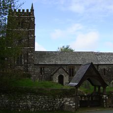
A circular walking route starts from the National Trust car park in Countisbury and crosses uneven ground with steep sections throughout. Sturdy footwear and waterproof clothing are important, as the forest floor can be wet and slippery.

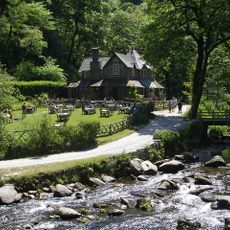
Where the East Lyn River meets Hoar Oak Water, several waterfalls appear and can be viewed from wooden bridges along the trail. These vantage points let visitors get close to the flowing water and hear its sound through the forest.

Location: Brendon and Countisbury

Address: Horner's Neck Wood, Lynmouth EX35, UK

GPS coordinates: 51.22575,-3.79651

Latest update: December 6, 2025 19:10

Photos
Historical places in Somerset away from tourists

Somerset preserves a broad range of historical sites away from the main visitor routes. The region shows medieval abbeys such as Muchelney and Cleeve, Norman castles like Stogursey and Nunney, Elizabethan manor houses including Cothay Manor and Lytes Cary, and prehistoric stone bridges such as Tarr...

Around this place
Watersmeet House
United Kingdom

Watersmeet House

348 m
Lynmouth Foreland Lighthouse
United Kingdom

Lynmouth Foreland Lighthouse

2.3 km
Rhenish Tower
United Kingdom

Rhenish Tower

2.5 km
Rock House Hotel
United Kingdom

Rock House Hotel

2.4 km
The Blue Ball Inn
United Kingdom

The Blue Ball Inn

696 m
Church of St John the Baptist
United Kingdom

Church of St John the Baptist

2.2 km
Church of Saint John
United Kingdom

Church of Saint John

842 m
Royal Castle Hotel
United Kingdom

Royal Castle Hotel

2.6 km
Church of St Brendan
United Kingdom

Church of St Brendan

1.3 km
Lyn Model Railway
United Kingdom

Lyn Model Railway

2.3 km
3 and 4, Mars Hill
United Kingdom

3 and 4, Mars Hill

2.5 km
Lynmouth Bridge Hotel
United Kingdom

Lynmouth Bridge Hotel

2.4 km
Bath Hotel With Pixie Dell
United Kingdom

Bath Hotel With Pixie Dell

2.5 km
Orchard House And Attached Front Boundary Wall
United Kingdom

Orchard House And Attached Front Boundary Wall

2.2 km
Hillside House And Front Terrace Wall And Railings
United Kingdom

Hillside House And Front Terrace Wall And Railings

2.1 km
Shelley's Cottage (Part Of Rising Sun Hotel)
United Kingdom

Shelley's Cottage (Part Of Rising Sun Hotel)

2.5 km
Royal Castle Lodge  (Formerly The Lodge)
United Kingdom

Royal Castle Lodge (Formerly The Lodge)

2.5 km
Pair Of Lime Kilns Approximately 200 Metres To East Of Watersmeet House
United Kingdom

Pair Of Lime Kilns Approximately 200 Metres To East Of Watersmeet House

297 m
K6 Telephone Kiosk
United Kingdom

K6 Telephone Kiosk

2.5 km
Summerhouse And Attached Retaining Wall And Terrace With Railings
United Kingdom

Summerhouse And Attached Retaining Wall And Terrace With Railings

2.2 km
Bonnicott
United Kingdom

Bonnicott

2.2 km
Terrace Balustrades And Steps To North And West Of The Manor House
United Kingdom

Terrace Balustrades And Steps To North And West Of The Manor House

2.3 km
Seabreeze Cottage
United Kingdom

Seabreeze Cottage

2.5 km
The Pier
United Kingdom

The Pier

2.5 km
Packhorse Bridge Approximately 30 Metres To West Of Leeford Bridge (That Part In Brendon Cp)
United Kingdom

Packhorse Bridge Approximately 30 Metres To West Of Leeford Bridge (That Part In Brendon Cp)

2.4 km
The Manor House And Attached Wall And Stable Block
United Kingdom

The Manor House And Attached Wall And Stable Block

2.3 km
Lyn Long Stones
United Kingdom

Lyn Long Stones

2.4 km
K6 Telephone Kiosk
United Kingdom

K6 Telephone Kiosk

2.3 km
Show the full map
Reviews

Visited this place? Tap the stars to rate it and share your experience / photos with the community! Try now! You can cancel it anytime.

« Horner's Neck Wood - Forest in Brendon and Countisbury, United Kingdom » is provided by Around Us (aroundus.com). Images and texts are derived from Wikimedia project under a Creative Commons license. You are allowed to copy, distribute, and modify copies of this page, under the conditions set by the license, as long as this note is clearly visible.

Discover hidden gems everywhere you go!

From secret cafés to breathtaking viewpoints, skip the crowded tourist spots and find places that match your style. Our app makes it easy with voice search, smart filtering, route optimization, and insider tips from travelers worldwide. Download now for the complete mobile experience.

Around Us App Screenshot

A unique approach to discovering new places

Le Figaro

All the places worth exploring

France Info

A tailor-made excursion in just a few clicks

20 Minutes