Kenhardt Golf Club
Location: Kai !Garib Local Municipality
GPS coordinates: -29.36138,21.13431
Latest update: December 3, 2025 01:06
Augrabies Falls
115.4 km
Slypsteenkrans
24.4 km
Skietkloof
93.7 km
Rooidam
9.3 km
Spitskop Natuurtuin
109 km
Three advertise boards
68.5 km
Ou Skool
69.8 km
Groblershoop Gholf Corse
97.1 km
Keimoes Water Mill
74.2 km
Pot Holes
115.4 km
Signs both side of river
72.1 km
Ouma Miemie
27.1 km
Ouma Miemie
27.3 km
Munincipal Blue Boards
68.3 km
Desert Palace Golf Course & Casino
105.6 km
Welcome to Keimoes
72.5 km
Eureka Golf Club
99.4 km
Small signs
70.2 km
Small signs
71.7 km
Few signs
72.8 km
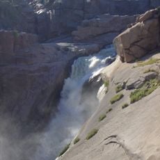
Scenic viewpoint
115.4 km
Scenic viewpoint
73.9 km
Scenic viewpoint
115.4 km
Scenic viewpoint
115.3 km
Game and Bird Hide
113.4 km
Vollgraaf Monument
93.3 km
Memorial, commemorative plaque
2.5 km
Kenhardt Drought Memorial
2.2 kmReviews
Visited this place? Tap the stars to rate it and share your experience / photos with the community! Try now! You can cancel it anytime.
Discover hidden gems everywhere you go!
From secret cafés to breathtaking viewpoints, skip the crowded tourist spots and find places that match your style. Our app makes it easy with voice search, smart filtering, route optimization, and insider tips from travelers worldwide. Download now for the complete mobile experience.

A unique approach to discovering new places❞
— Le Figaro
All the places worth exploring❞
— France Info
A tailor-made excursion in just a few clicks❞
— 20 Minutes