Sirikit Dam Golf Course
Location: จังหวัดอุตรดิตถ์
GPS coordinates: 17.73452,100.54087
Latest update: December 3, 2025 12:43
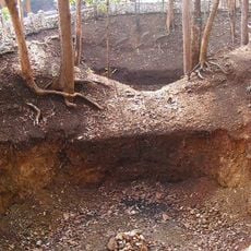
Nam Phi iron mine
33.5 km
Wat Phra Fang Sawang Khaburimuninat
34.9 km
Ton Sak Yai National Park
27.6 km
Tham Chan Forest Park
21 km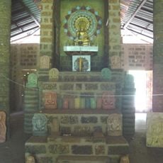
Ban Nong Bua monastic residence
36 km
Wat Yang Thon
28.5 km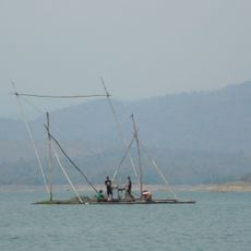
Sirikit Reservoir
18.8 km
Ang Kep Nam Ban Wang Chomphu
24.1 km
Ang Kep Nam Khlong Tron
16.2 km
Nam Tok Huai Pong
25.7 km
Ang Kep Nam Huai Pa Khai
35.8 km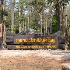
Ton Sak Yai forest park
9.1 km
Wat Pha Chalk
32.3 km
Wat Ban Lum
35.9 km
Chan Cave
21.2 km
Mahasak
9.1 km
Lek Nam Phi Ancient Iron Ore Mine
33.5 km
ภูพญาพ่อ
32.8 km
Nothing To See Over Trees
27 km
Viewpoint
26.5 km
Scenic viewpoint
33.2 km
Scenic viewpoint
25.2 km
Scenic viewpoint
25.4 km
Scenic viewpoint
25.5 km
Scenic viewpoint
25.2 km
Scenic viewpoint
18.6 km
Monument
3.5 km
Waterfall
33.4 kmVisited this place? Tap the stars to rate it and share your experience / photos with the community! Try now! You can cancel it anytime.
Discover hidden gems everywhere you go!
From secret cafés to breathtaking viewpoints, skip the crowded tourist spots and find places that match your style. Our app makes it easy with voice search, smart filtering, route optimization, and insider tips from travelers worldwide. Download now for the complete mobile experience.

A unique approach to discovering new places❞
— Le Figaro
All the places worth exploring❞
— France Info
A tailor-made excursion in just a few clicks❞
— 20 Minutes