Taroom Golf Club
Location: Taroom
Location: Banana Shire
GPS coordinates: -25.64663,149.81036
Latest update: November 3, 2025 14:03

Leichhardt Tree, Taroom
1.6 km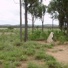
Taroom Aboriginal Settlement
10.2 km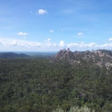
Isla Gorge National Park
57.4 km
Palmgrove National Park
91 km
Precipice National Park
45.8 km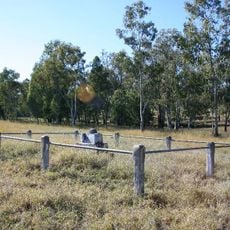
Fraser family grave site and memorial, Hornet Bank
42.5 km
Waaje Fire Tower No.4
84.7 km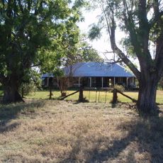
The Glebe Homestead
26.3 km
Theodore Home & Garden Cafe
82.3 km
Carraba Conservation Park
20.2 km
Town Weir
83.1 km
Lonesome National Park
99.5 km
Gorge Floor Access
74.8 km
Scenic viewpoint
53.3 km
Theodore Golf Club
82 km
Gilbert's Lookout
1.3 km
Scenic viewpoint
101.5 km
Scenic viewpoint
23.8 km
View of Lidwig Leichhardt's Conicle Hill
65.6 km
Red Shag on a White Rock
78.4 km
Cattle Dip Lookout
71.4 km
Scenic viewpoint
1.2 km
Scenic viewpoint
53.7 km
Robinson Gorge Lookout
74.6 km
Memorial
1.4 km
Old Vanguard sedan
98.3 km
Cracow ANZAC Memorial
63.1 km
Memorial
54.9 kmReviews
Visited this place? Tap the stars to rate it and share your experience / photos with the community! Try now! You can cancel it anytime.
Discover hidden gems everywhere you go!
From secret cafés to breathtaking viewpoints, skip the crowded tourist spots and find places that match your style. Our app makes it easy with voice search, smart filtering, route optimization, and insider tips from travelers worldwide. Download now for the complete mobile experience.

A unique approach to discovering new places❞
— Le Figaro
All the places worth exploring❞
— France Info
A tailor-made excursion in just a few clicks❞
— 20 Minutes