Rand Golf Course
Location: Rand
Location: Greater Hume Shire Council
GPS coordinates: -35.61619,146.61067
Latest update: November 22, 2025 08:19

Wirraminna Environmental Education Centre
30.5 km
Lonesome Pine State Forest
24.2 km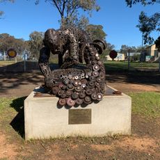
Shearing of the Ram
34.5 km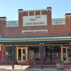
Culcairn Library
38.6 km
Howlong Library
40.5 km
Henty Library
40.3 km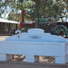
Horse trough
40.9 km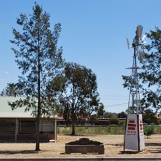
Horse trough
40 km
John McLean's Grave
41.9 km
Mural, Work of art
31 km
Howlong Golf Course
41.4 km
Culcairn Golf Course
40.4 km
Walla Walla Golf Course (Abandoned)
31.3 km
Henty Man
39.1 km
Henty Golf Course
39.4 km
Ruston old Starting Oil Engine Restoration Project
40.9 km
Statue, Work of art
40 km
Oaklands Golf Course
41.2 km
Work of art, mural
38.9 km
Scenic viewpoint
12 km
Morgan's Lookout
25.5 km
Memorial, war memorial
3.9 km
War Memorial
38.8 km
Walla Walla War Memorial
31.2 km
Memorial, war memorial
40.9 km
Sergeant Smyth Memorial
38.4 km
The Culcairn Wishing Well
38.9 km
Memorial
3.6 kmReviews
Visited this place? Tap the stars to rate it and share your experience / photos with the community! Try now! You can cancel it anytime.
Discover hidden gems everywhere you go!
From secret cafés to breathtaking viewpoints, skip the crowded tourist spots and find places that match your style. Our app makes it easy with voice search, smart filtering, route optimization, and insider tips from travelers worldwide. Download now for the complete mobile experience.

A unique approach to discovering new places❞
— Le Figaro
All the places worth exploring❞
— France Info
A tailor-made excursion in just a few clicks❞
— 20 Minutes