Driving Range
Location: Hürth
Operator: Golfpartner
GPS coordinates: 50.86504,6.90019
Latest update: October 8, 2024 00:02
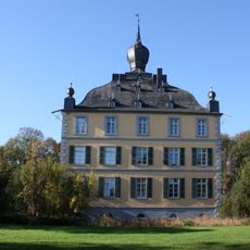
Burg Kendenich
829 m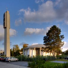
Sankt Ursula (Hürth)
1.4 km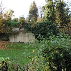
Fischenich Castle
660 m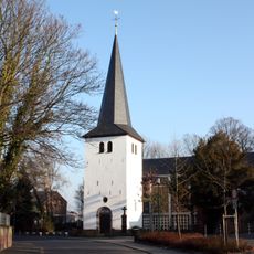
St. Johann Baptist
914 m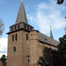
St. Martin
763 m
Former Nathan-Söderblom-Kirche
969 m
Kendenich
691 m
Catholic church building, wayside cross, Christianity
1.1 km
Albert Levy
1.1 km
Catholic church building, wayside cross, Christianity
932 m
Catholic church building, wayside cross, Christianity
935 m
Catholic church building, wayside cross, Christianity
960 m
Burg Fischenich (Ruine)
661 m
War memorial, memorial
520 m
Herbert Levy
1.1 km
Werner Levy
1.1 km
Arthur Levy
1.1 km
Wilhelmine Levy
1.1 km
Catholic church building, wayside cross, Christianity
773 m
Sybilla Levy
1.1 km
Scenic viewpoint
1.1 km
Catholic church building, wayside cross, Christianity
1.2 km
Catholic church building, wayside cross, Christianity
1.2 km
Catholic church building, wayside cross, Christianity
1.3 km
Scenic viewpoint
1.3 km
Wolterskreuz
1.4 km
Catholic church building, wayside cross, Christianity
411 m
Wayside cross
1.6 kmReviews
Visited this place? Tap the stars to rate it and share your experience / photos with the community! Try now! You can cancel it anytime.
Discover hidden gems everywhere you go!
From secret cafés to breathtaking viewpoints, skip the crowded tourist spots and find places that match your style. Our app makes it easy with voice search, smart filtering, route optimization, and insider tips from travelers worldwide. Download now for the complete mobile experience.

A unique approach to discovering new places❞
— Le Figaro
All the places worth exploring❞
— France Info
A tailor-made excursion in just a few clicks❞
— 20 Minutes