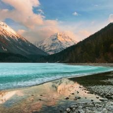
Комплекс по изучению кабарги нац парк Белуха
Location: Катандинское сельское поселение
GPS coordinates: 50.00832,86.39293
Latest update: November 17, 2025 00:41
Lake Kucherla
14.8 km
Valley of seven lakes
14.6 km
Scenic viewpoint
13.2 km
Лучший вид на озеро
12.7 km
1-й водопад Большого Колагаша
6.2 km
Scenic viewpoint
11.4 km
Scenic viewpoint
12.4 km
Урочище Елань ( 1000 м. над ур.м. )
11.1 km
Обзорная площадка на водопад
9.8 km
Плато Сарыбель
13.1 km
Scenic viewpoint
12.9 km
Scenic viewpoint
10.5 km
Scenic viewpoint
13.4 km
Scenic viewpoint
14.5 km
Scenic viewpoint
9.2 km
Scenic viewpoint
8.1 km
Каменная изба
6.5 km
Наскальные рисунки
3 km
Каякеру
9.1 km
Memorial
8.1 km
2-й водопад Большого Кулагаша
10.3 km
Малый Текелю
10.1 km
Высотник
13.6 km
Текелю
13.3 km
Кульдураюк
14.8 km
Cлёзы Девушки
13.3 km
3-й водопад Большого Колагаша
12.9 km
Водопад Тегеек
9.7 kmReviews
Visited this place? Tap the stars to rate it and share your experience / photos with the community! Try now! You can cancel it anytime.
Discover hidden gems everywhere you go!
From secret cafés to breathtaking viewpoints, skip the crowded tourist spots and find places that match your style. Our app makes it easy with voice search, smart filtering, route optimization, and insider tips from travelers worldwide. Download now for the complete mobile experience.

A unique approach to discovering new places❞
— Le Figaro
All the places worth exploring❞
— France Info
A tailor-made excursion in just a few clicks❞
— 20 Minutes