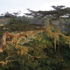
BAI
Location: District de Mokeko
GPS coordinates: 0.76686,15.25329
Latest update: October 15, 2025 22:12
Dzanga-Ndoki National Park
218.1 km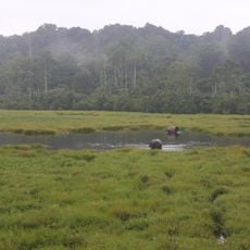
Mbeli Bai
210.2 km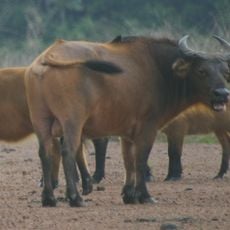
Lobéké National Park
174.1 km
Odzala National Park
35.8 km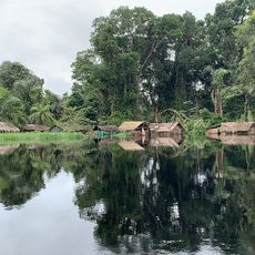
Ntokou-Pikounda National Park
151.6 km
Mont Nabemba
184.8 km
Stade Omnisport Marien Ngouabi d'Owando
156.1 km
African Parks Office. Otzala-Kokoua National Park
128.5 km
Mangui River
155.1 km
Clairière De Ndjangui
182 km
Aussichtsturm petit Savane
177.5 km
Clairère Ndangaye
192 km
Clairière de Djaloumbé
187.8 km
OUALI BAI
194.5 km
WWF Yumbi bai field base
182.1 km
WSC. Org. Headquarters Nouabale-Ndoki
128.1 km
Sangha-Ndoki
148.6 km
.
221.3 km
Ponda Camp
190.9 km
BALOUMA PYGMY VILLAGE
144.9 km
Pecheurs
210.8 km
Chief yard
155.6 km
MARCHE DE VIEND
129.2 km
MARCHE
129.5 km
Trailhead Ikei Bokaboka to Mt Bengoué
174 km
Nki Nationalpark
202.8 km
Observatoire
194.4 km
Rivière Noire
145.7 kmReviews
Visited this place? Tap the stars to rate it and share your experience / photos with the community! Try now! You can cancel it anytime.
Discover hidden gems everywhere you go!
From secret cafés to breathtaking viewpoints, skip the crowded tourist spots and find places that match your style. Our app makes it easy with voice search, smart filtering, route optimization, and insider tips from travelers worldwide. Download now for the complete mobile experience.

A unique approach to discovering new places❞
— Le Figaro
All the places worth exploring❞
— France Info
A tailor-made excursion in just a few clicks❞
— 20 Minutes