Arthurs place
Location: Fanteakwa North District
GPS coordinates: 6.49334,-0.30942
Latest update: November 6, 2025 14:15
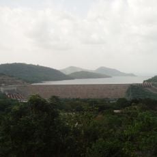
Akosombo Dam
46.1 km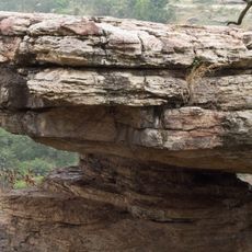
Umbrella Rock
39.2 km
Atewa Range
48.5 km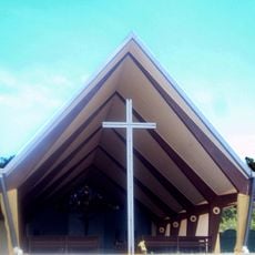
St. Barbara Catholic Church
45.2 km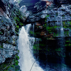
Akaa Falls
37.6 km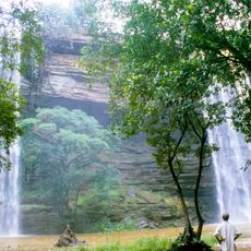
Boti Falls
35 km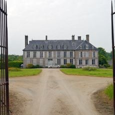
Château de Torchamp
42.8 km
Akwawa
13.7 km
Department of Parks and Gardens
45.1 km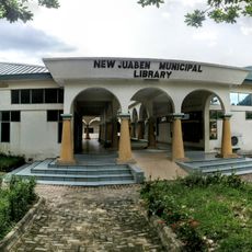
Eastern Regional Library, GhLA
45.4 km
Bunso Canopy walk
30.2 km
Scenic viewpoint
52.4 km
Umbrella Rock
36 km
3 in 1 Palm Tree
36.2 km
Huhunya Waterfalls
39.7 km
Market and taxi station
46.7 km
Centre For National Culture
46.5 km
Twin Islands Reception
50.3 km
Scenic viewpoint
52.7 km
Akaa Falls
37.6 km
Scenic viewpoint
52.4 km
Tafo Ati Ahenfie
31.4 km
Nana Kwasi Anyane Adontehene's Palace, Anum
51 km
Abomosu Palace
50.7 km
Chief's Palace
47.1 km
Oku Abena waterfall
47.7 km
Huhunya Waterfalls
39.7 km
Oworobong waterfall
24.1 kmReviews
Visited this place? Tap the stars to rate it and share your experience / photos with the community! Try now! You can cancel it anytime.
Discover hidden gems everywhere you go!
From secret cafés to breathtaking viewpoints, skip the crowded tourist spots and find places that match your style. Our app makes it easy with voice search, smart filtering, route optimization, and insider tips from travelers worldwide. Download now for the complete mobile experience.

A unique approach to discovering new places❞
— Le Figaro
All the places worth exploring❞
— France Info
A tailor-made excursion in just a few clicks❞
— 20 Minutes