Quiver Tree Forest
Location: Hardap Region
Operator: Hauchabfontein Farm
GPS coordinates: -24.48369,16.07484
Latest update: November 18, 2025 07:59
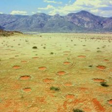
Fairy circle
53.9 km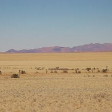
NamibRand Nature Reserve
58 km
Franke Tower
14.7 km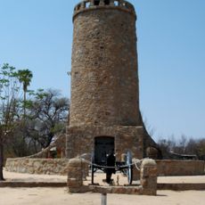
Battlefield around Franke Tower
14.7 km
Schwarze Kuppe
56.2 km
Sesriem Canyon
28.2 km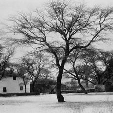
Rhenish Mission House
14.7 km
Elim Dune
31.5 km
Scenic viewpoint
11.7 km
Petroglyphs
43.1 km
Fairy Circles
41.9 km
Sunset viewpoint
44.8 km
Sesriem Canyon
28.7 km
Scenic viewpoint
46.2 km
Sesriem Canyon
28.2 km
Klipspringer
8 km
Platkop View
11 km
Tsaris Viewpoint
7.4 km
Petrified Dunes
44.4 km
Scenic viewpoint
23.7 km
Scenic viewpoint
6 km
Scenic viewpoint
8 km
Scenic viewpoint
44.2 km
Scenic viewpoint
35.1 km
UNESCO world heritage plaque
35.5 km
Rudolf Rogge
47.5 km
August Schern
47.5 km
Waterfall
39.2 kmReviews
Visited this place? Tap the stars to rate it and share your experience / photos with the community! Try now! You can cancel it anytime.
Discover hidden gems everywhere you go!
From secret cafés to breathtaking viewpoints, skip the crowded tourist spots and find places that match your style. Our app makes it easy with voice search, smart filtering, route optimization, and insider tips from travelers worldwide. Download now for the complete mobile experience.

A unique approach to discovering new places❞
— Le Figaro
All the places worth exploring❞
— France Info
A tailor-made excursion in just a few clicks❞
— 20 Minutes