Afri-Abseil
Location: Bitou Local Municipality
GPS coordinates: -33.94288,23.49719
Latest update: November 20, 2025 13:25
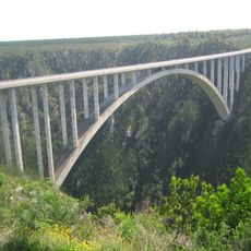
Bloukrans Bridge
13.9 km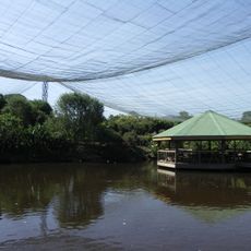
Birds of Eden
2.5 km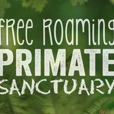
Monkeyland
2.9 km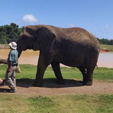
Elephant Sanctuary, The Crags, Plettenberg Bay
2.6 km
Lawnwood snake sanctuary
2.9 km
Keurboomsrivier Natuurreservaat
10.1 km
Keurboomstrand
11.5 km
Bloukrans Bridge Viewpoint
14.1 km
Kalandarkloof hike
4.9 km
Jukani Wildlife Sanctuary
6.9 km
Plett Puzzle Park
6.8 km
Einstieg in die Canyoning Tour
1.2 km
Arch Rock
7.1 km
Tenikwa Wildlife Rehabilitation and Awareness Centre
2.5 km
AfriCanyon River Adventures
1.8 km
Bramon Tasting Room
2.2 km
Arch Rock
7 km
Picknick table and start of hike
4.8 km
Scenic viewpoint
5.9 km
Scenic viewpoint
6.5 km
Scenic viewpoint
945 m
Scenic viewpoint
3.6 km
Natur
6.5 km
Scenic viewpoint
5.6 km
Scenic viewpoint
8.1 km
Archaeological site
7 km
Waterfall
2.6 km
Waterfall
10.6 kmReviews
Visited this place? Tap the stars to rate it and share your experience / photos with the community! Try now! You can cancel it anytime.
Discover hidden gems everywhere you go!
From secret cafés to breathtaking viewpoints, skip the crowded tourist spots and find places that match your style. Our app makes it easy with voice search, smart filtering, route optimization, and insider tips from travelers worldwide. Download now for the complete mobile experience.

A unique approach to discovering new places❞
— Le Figaro
All the places worth exploring❞
— France Info
A tailor-made excursion in just a few clicks❞
— 20 Minutes