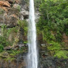
Magnetite heights
Location: Greater Tubatse Local Municipality
GPS coordinates: -24.83785,29.97174
Latest update: October 16, 2025 14:53
Lone Creek Falls
80 km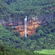
Bridal Veil Falls
80.6 km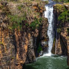
Sabie Falls
86.1 km
Horseshoe Falls
79.9 km
Potlake Nature Reserve
66.6 km
Dullstroom Bird Of Prey & Rehabilitation Centre
68.2 km
Kleinfontein
53.6 km
Voortrekkerbad
42.9 km
Long Tom Cannon
80.1 km
Paragliding Launch site
80.1 km
Dwars river national heritage site
15.6 km
Abel Erasmus Pas
74.8 km
Marble Hall Foundation Stone
71.4 km
Abel Erasmus Pass
74.7 km
Big Joe
83.1 km
Verlorenvlei
52 km
Wattle Crane
51.9 km
Falcon Glen Country Estate (Holiday Club)
82.6 km
Bridal Veil Falls
80.6 km
Scenic viewpoint
74 km
Horse-Shoe Falls
79.8 km
Scenic viewpoint
80.2 km
Scenic viewpoint
59.4 km
Long Tom View
74.2 km
Scenic viewpoint
50.7 km
Lone Creek Falls
80.1 km
The Staircase Viewpoint
74.8 km
Scenic viewpoint
74.9 kmReviews
Visited this place? Tap the stars to rate it and share your experience / photos with the community! Try now! You can cancel it anytime.
Discover hidden gems everywhere you go!
From secret cafés to breathtaking viewpoints, skip the crowded tourist spots and find places that match your style. Our app makes it easy with voice search, smart filtering, route optimization, and insider tips from travelers worldwide. Download now for the complete mobile experience.

A unique approach to discovering new places❞
— Le Figaro
All the places worth exploring❞
— France Info
A tailor-made excursion in just a few clicks❞
— 20 Minutes