Anglo-Boer War Blockhouse
Location: Midvaal Local Municipality
GPS coordinates: -26.46833,28.06913
Latest update: November 11, 2025 16:48
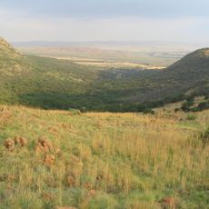
Suikerbosrand Nature Reserve
18.4 km
Klipriviersberg Nature Reserve
19.2 km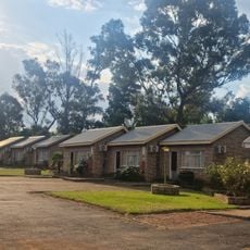
Fun Valley
21.6 km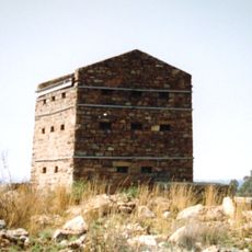
Witkop Blockhouse
269 m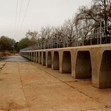
Kidson Weir
9 km
Suikerbosrant Nature Reserve
13.9 km
Scenic viewpoint
14.4 km
Archaeological site, tourist attraction
21.3 km
Tswana Reconstruction
18.9 km
Pioneer House and Cemetery
14.2 km
Glenvista Country Club
20.9 km
Triangulation station, survey marker, scenic viewpoint
19.5 km
Scenic viewpoint
21.9 km
Scenic viewpoint
19.9 km
Tedderfield Airpark
16.3 km
Vierfontein Dame
21.4 km
Tourist attraction, archaeological site
21.2 km
Southdowns Country Club
17.6 km
Tourist attraction, archaeological site
21.3 km
Tourist attraction, archaeological site
21 km
Tourist attraction, archaeological site
21 km
Archaeological site, tourist attraction
21 km
Tourist attraction, archaeological site
20 km
Tourist attraction, archaeological site
18.8 km
Archaeological site, tourist attraction
18.7 km
Tourist attraction, archaeological site
21.4 km
Tourist attraction, archaeological site
21.3 km
Tourist attraction, archaeological site
21.4 kmReviews
Visited this place? Tap the stars to rate it and share your experience / photos with the community! Try now! You can cancel it anytime.
Discover hidden gems everywhere you go!
From secret cafés to breathtaking viewpoints, skip the crowded tourist spots and find places that match your style. Our app makes it easy with voice search, smart filtering, route optimization, and insider tips from travelers worldwide. Download now for the complete mobile experience.

A unique approach to discovering new places❞
— Le Figaro
All the places worth exploring❞
— France Info
A tailor-made excursion in just a few clicks❞
— 20 Minutes