Bon Cap Winery
Location: Langeberg Local Municipality
GPS coordinates: -33.78345,19.68127
Latest update: November 17, 2025 12:08

Keerom Dam
22.1 km
Klipberg Dam
20.2 km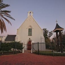
Church of St James the Great, Worcester
26.7 km
Jonaskop
26.3 km
Elandsberg South
27.3 km
Suurberg
16.7 km
Saw Edge Peak
21.4 km
Bakenskop
10 km
Keerom Reservoir
22.5 km
Eseltjiesrus Donkey Sanctuary
23.7 km
Red Chair
7.5 km
Vrolijkheid Hiking start
23.5 km
Space Harley rock formation
18.7 km
Rock Overhang
25.9 km
Silwerstrand Golf and River Estate
16 km
Hex River Cellar
20.8 km
Sophies Choice
18.5 km
Eagle’s Cliff Tasting Room
25.1 km
De Wet Cellar
25.3 km
Haybale People
17.1 km
Wine Barrel
5.9 km
Twin Peaks viewpoint
20.1 km
Tierkloof 4x4
27.4 km
Voortrekker
26.9 km
Early house ruin
17.3 km
Nelson Mandela
26.9 km
Oakes Falls
26.9 km
Waterfall
25.9 kmReviews
Visited this place? Tap the stars to rate it and share your experience / photos with the community! Try now! You can cancel it anytime.
Discover hidden gems everywhere you go!
From secret cafés to breathtaking viewpoints, skip the crowded tourist spots and find places that match your style. Our app makes it easy with voice search, smart filtering, route optimization, and insider tips from travelers worldwide. Download now for the complete mobile experience.

A unique approach to discovering new places❞
— Le Figaro
All the places worth exploring❞
— France Info
A tailor-made excursion in just a few clicks❞
— 20 Minutes