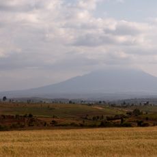
Lake singida
Location: Singida Municipal
GPS coordinates: -4.78278,34.76222
Latest update: November 16, 2025 16:08
Mount Hanang
80.9 km
Luxmanda
84.5 km
Itigi District
107 km
Mbutu Bridge
112 km
Sibiti Bridge
55 km
Ughandi B turning
17.2 km
Isanjandugu Watet Source
103.2 km
Lake singida
300 m
Kilimatinde view point
122.2 km
Colonial grave's
121.9 km
Ngome ya wakoloni wa kiingereza kilimatinde
121.5 km
Masquaroda
117.3 km
Path continues
120 km
Reserved Area
22.8 km
Kondoa Rock Art Reserve
123.8 km
Kinyika Poultry Project
94.5 km
Lake kindai
7.5 km
Kinyika Village
93.5 km
River
88.9 km
Ighuka Secondary
36.7 km
Ngaya valley
27.3 km
Mwandugembe dispensary
22.9 km
Ruins
111.9 km
Monument
67.7 km
B2
123.9 km
B3
124.1 km
Central railway
27.3 km
Waterfall
25.1 kmReviews
Visited this place? Tap the stars to rate it and share your experience / photos with the community! Try now! You can cancel it anytime.
Discover hidden gems everywhere you go!
From secret cafés to breathtaking viewpoints, skip the crowded tourist spots and find places that match your style. Our app makes it easy with voice search, smart filtering, route optimization, and insider tips from travelers worldwide. Download now for the complete mobile experience.

A unique approach to discovering new places❞
— Le Figaro
All the places worth exploring❞
— France Info
A tailor-made excursion in just a few clicks❞
— 20 Minutes