Entry point
Location: Senanga District
GPS coordinates: -16.65863,23.58856
Latest update: November 14, 2025 13:18
Kavango–Zambezi Transfrontier Conservation Area
161.9 km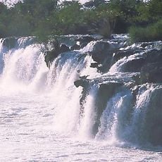
Ngonye Falls
1.8 km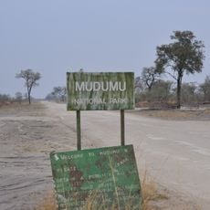
Mudumu National Park
149.6 km
Sioma Ngwezi National Park
39.2 km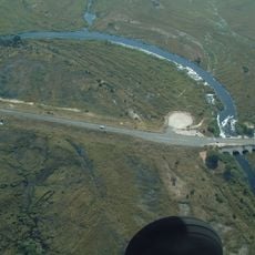
Kongolabrücke
128.7 km
Katima Mulilo Rapids
114.2 km
Chilemve
96 km
Bumbui Rapids
47.7 km
Sioma
2.3 km
Horseshoe
141.9 km
Scenic viewpoint
132.9 km
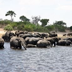
Hippo Pool
164 km
Scenic viewpoint
163.8 km
Waterhole
161.5 km
Kwando Traditional Village
155.9 km
Hunting Camp
122.7 km
Scenic viewpoint
130.4 km
Scenic viewpoint
143.2 km
Horseshoe
141.5 km
Scenic viewpoint
132.5 km
Scenic viewpoint
133.6 km
Scenic viewpoint
151 km
Ngonye Falls
2 km
Ngonye Falls
2 km
Ngonje falls
1.5 km
Ngonye Falls
2.1 km
Ngonye Falls
1.5 km
Ngonye Falls
2.1 kmReviews
Visited this place? Tap the stars to rate it and share your experience / photos with the community! Try now! You can cancel it anytime.
Discover hidden gems everywhere you go!
From secret cafés to breathtaking viewpoints, skip the crowded tourist spots and find places that match your style. Our app makes it easy with voice search, smart filtering, route optimization, and insider tips from travelers worldwide. Download now for the complete mobile experience.

A unique approach to discovering new places❞
— Le Figaro
All the places worth exploring❞
— France Info
A tailor-made excursion in just a few clicks❞
— 20 Minutes