黄河源
Location: 玛多县 རྨ་སྟོད་རྫོང།
GPS coordinates: 34.99979,97.54123
Latest update: November 13, 2025 00:26

Bayan Har Mountains
61.3 km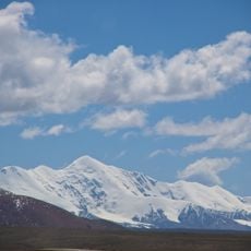
Amne Machin
178.3 km
Sanjiangyuan National Nature Reserve
164.8 km
Dongdre-Kloster
185.5 km
Reshui Tombs
148 km
Har Sai Shan
49.7 km
Mountain pass 4812m
173.8 km
Viewpoint 4829M
97.8 km
Daqinlong Pass
187.2 km
星星海生态旅游景区
57.3 km
Tibet letters
188.3 km
Tibet letters
190.3 km
4825m pass
97.3 km
Mountain pass 4660m approx
144 km
Jialongshan Pass
182.9 km
Saddle 3518m
132.1 km
G214 Road Marker 555
79.9 km
Malongchacong Pass
182.7 km
Monument
187.8 km
Monument
186.3 km
黄河源头
123.5 km
Memorial
185 km
Ruins
59 km
Ruins
59.3 km
2021年玛多地震
58.8 km
黄金佛塔(黄河源头)
142 km
尕日塘秦刻石
19.8 km
Memorial, war memorial
186.3 kmReviews
Visited this place? Tap the stars to rate it and share your experience / photos with the community! Try now! You can cancel it anytime.
Discover hidden gems everywhere you go!
From secret cafés to breathtaking viewpoints, skip the crowded tourist spots and find places that match your style. Our app makes it easy with voice search, smart filtering, route optimization, and insider tips from travelers worldwide. Download now for the complete mobile experience.

A unique approach to discovering new places❞
— Le Figaro
All the places worth exploring❞
— France Info
A tailor-made excursion in just a few clicks❞
— 20 Minutes