גזע עץ
Location: מועצה אזורית מגילות ים המלח
GPS coordinates: 31.62240,35.42752
Latest update: November 11, 2025 16:41

שמורת קנה וסמר
3.3 km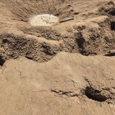
"בולען"
1.8 km
תצפית מפל קדרון
6.1 km
תצפית סינגל החמור
5.3 km
Scenic viewpoint
3.7 km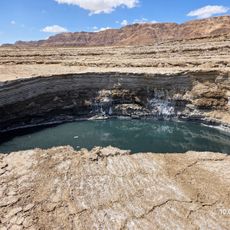
בולען
1.5 km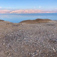
מצפה אפס
5.5 km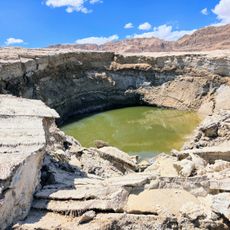
"בולען"
1.7 km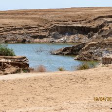
תצפית על מאגר מים. קרקע לא יציבה, מסוכן להתקרב!! (10-4-2025)
1.8 km
Scenic viewpoint
4.1 km
Backhoe loader
4.9 km
Scenic viewpoint
2.4 km
Scenic viewpoint
2.8 km
Scenic viewpoint
6.1 km
Scenic viewpoint
6.1 km
תצפית לים המלח
4.6 km
Nachliel Lookout
6.1 km
Metzoke Dragot beach
5.1 km
Scenic viewpoint
3.1 km
"עוגיות"
2.1 km
בולען
840 m
מפרץ הפטריות
1.6 km
מפל טור
4 km
Waterfall
2.5 km
מפל תמרים
2.9 km
Waterfall
2.5 km
Waterfall
2.5 km
Waterfall
2.5 kmReviews
Visited this place? Tap the stars to rate it and share your experience / photos with the community! Try now! You can cancel it anytime.
Discover hidden gems everywhere you go!
From secret cafés to breathtaking viewpoints, skip the crowded tourist spots and find places that match your style. Our app makes it easy with voice search, smart filtering, route optimization, and insider tips from travelers worldwide. Download now for the complete mobile experience.

A unique approach to discovering new places❞
— Le Figaro
All the places worth exploring❞
— France Info
A tailor-made excursion in just a few clicks❞
— 20 Minutes