Notza Ridge
Location: מועצה אזורית חבל אילות
GPS coordinates: 30.14987,35.13619
Latest update: October 18, 2025 18:30
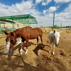
Red Mountain Therapeutic Riding Center
24.2 km
תצפית חדוד
22.4 km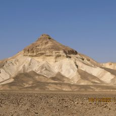
גבעת בוהר
18.8 km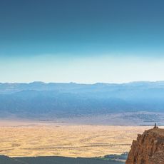
Summit, hill, scenic viewpoint, mountain
22.5 km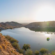
Eshet Hadasa Reservoir
22.1 km
Scenic viewpoint
15 km
Scenic viewpoint
19.9 km
בולבוסים
9.6 km
בולדרים
23.7 km
סלע עם גבישי קוורץ
24.5 km
Scenic viewpoint
18.1 km
Scenic viewpoint
18.5 km
Scenic viewpoint
18.5 km
Kasuy Sands
24.3 km
Tsihor palace
19.1 km
Scenic viewpoint, bunker
19 km
ביצת הפתעה (עצמון)
20.4 km
מצפור פארן
23.2 km
Scenic viewpoint
21.2 km
Red Mountain Therapeutic Riding Center
24.3 km
Cracks
17.1 km
Scenic viewpoint
19.2 km
מצפה יהודית
14.8 km
Cracks
17.5 km
Scenic viewpoint
18.2 km
Scenic viewpoint
18.2 km
מצפור הר עיט
16.1 km
Scenic viewpoint
10.6 kmReviews
Visited this place? Tap the stars to rate it and share your experience / photos with the community! Try now! You can cancel it anytime.
Discover hidden gems everywhere you go!
From secret cafés to breathtaking viewpoints, skip the crowded tourist spots and find places that match your style. Our app makes it easy with voice search, smart filtering, route optimization, and insider tips from travelers worldwide. Download now for the complete mobile experience.

A unique approach to discovering new places❞
— Le Figaro
All the places worth exploring❞
— France Info
A tailor-made excursion in just a few clicks❞
— 20 Minutes