山神社社叢
Location: 豊岡市
Operator: 山神社
GPS coordinates: 35.48957,134.70339
Latest update: November 18, 2025 03:07
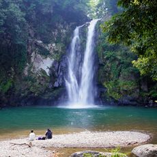
Hattan Falls
1.8 km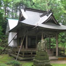
Tono-jinja
1.5 km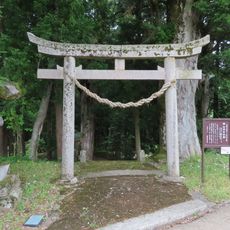
Yama-jinja
29 m
Kyū Ōokaji teien
2.6 km
Wayside shrine
609 m
Memorial
2.7 km
Wayside shrine
2.3 km
Wayside shrine
2.2 km
Buddhism, wayside shrine
2.4 km
Wayside shrine, Buddhism
2.3 km
Buddhism, wayside shrine
1.7 km
Wayside shrine
2.9 km
Wayside shrine
611 m
Wayside shrine
611 m
Ooka Golf Club
2.6 km
栃本の溶岩瘤
995 m
Stele, memorial
2.7 km
Buddhism, wayside shrine
2 km
Buddhism, wayside shrine
1.9 km
Wayside shrine
339 m
Archaeological site
2.9 km
二十六番 聖観世音
2.9 km
Wayside shrine
2.9 km
二十五番 十一面観世音
2.9 km
Wayside shrine
3 km
神鍋発祥之碑
2.9 km
Wayside shrine
2.9 km
二段滝
1 kmReviews
Visited this place? Tap the stars to rate it and share your experience / photos with the community! Try now! You can cancel it anytime.
Discover hidden gems everywhere you go!
From secret cafés to breathtaking viewpoints, skip the crowded tourist spots and find places that match your style. Our app makes it easy with voice search, smart filtering, route optimization, and insider tips from travelers worldwide. Download now for the complete mobile experience.

A unique approach to discovering new places❞
— Le Figaro
All the places worth exploring❞
— France Info
A tailor-made excursion in just a few clicks❞
— 20 Minutes