Digo's Hills
Location: Doña Remedios Trinidad
GPS coordinates: 15.09386,121.09810
Latest update: November 12, 2025 03:48
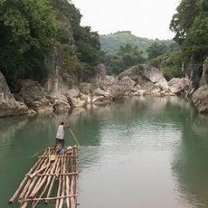
Biak-na-Bato National Park
3.3 km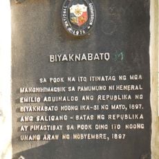
Biyaknabato historical marker
3.5 km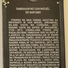
Church of San Miguel de Mayumo historical marker
14 km
Caves of Madlum
8.6 km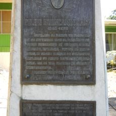
Felipe Buencamino, Sr. historical marker
13.9 km
Caves of Tankey
3.3 km
Caves of Bahay Paniqui
2.5 km
MARILOU AGA
13.9 km
Candle Monument
3.6 km
Tila Pilon Hills
3.6 km
Dh
11.9 km
Sibul Springs Compound
9.1 km
Mount Gola
7.8 km
Mount Manalmon
7.7 km
Buliran Karnabal
13.9 km
DENNIS DE GUZMAN
12.6 km
Farm of Eleuterio
14 km
Scenic viewpoint
6.5 km
Mansion Holiday Resort
10.3 km
Rizal Monument
14 km
Verdivia Falls
1.7 km
Mandala Falls
11.1 km
Talon Pari Falls
7.2 km
DRT
12 km
Daan Kareta Falls
11.2 km
Samora Falls
10.7 km
Malangaan Falls
10.7 km
13th Falls
3.7 kmReviews
Visited this place? Tap the stars to rate it and share your experience / photos with the community! Try now! You can cancel it anytime.
Discover hidden gems everywhere you go!
From secret cafés to breathtaking viewpoints, skip the crowded tourist spots and find places that match your style. Our app makes it easy with voice search, smart filtering, route optimization, and insider tips from travelers worldwide. Download now for the complete mobile experience.

A unique approach to discovering new places❞
— Le Figaro
All the places worth exploring❞
— France Info
A tailor-made excursion in just a few clicks❞
— 20 Minutes