Рудный парк
Location: Ковдорский муниципальный округ
GPS coordinates: 67.56075,30.47132
Latest update: October 25, 2025 08:04
Korvatunturi
74.7 km
Lapland Biosphere Reserve
62.8 km
Tuntsa Wilderness Area
39.6 km
Värriö Strict Nature Reserve
40 km
Värriö Subarctic Research Station
42 km
Komsozero
26.1 km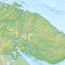
Заячья Тундра
71.7 km
Kuruvaara Quarry
44.2 km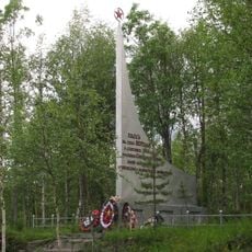
Verman Rubezh
63.9 km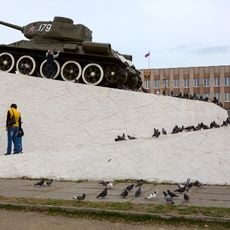
T-34-85 in Alakurtti
67.1 km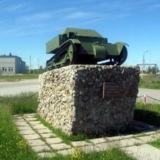
Памятник «Танкетка Т-27»
67 km
Ozero Ilimyaynen Purstelampi
85.8 km
Плотина
77.7 km
Scenic viewpoint
89.9 km
Танк
67.1 km
Умка и северное сияние
88.3 km
Николай II
736 m
Scenic viewpoint
49.5 km
Начало дороги на Авва-Губа
49.5 km
Танкетка
67 km
Scenic viewpoint
15.3 km
Scenic viewpoint
74.3 km
Scenic viewpoint
73.7 km
Вид на залив и горы
87.5 km
Вид на залив и горы
87.8 km
Lattunavaara
76.2 km
Voittinköngäs näköalapaikka
63.5 km
Pikkusaukkosuvannonvaara näköalapaikka
63.6 kmReviews
Visited this place? Tap the stars to rate it and share your experience / photos with the community! Try now! You can cancel it anytime.
Discover hidden gems everywhere you go!
From secret cafés to breathtaking viewpoints, skip the crowded tourist spots and find places that match your style. Our app makes it easy with voice search, smart filtering, route optimization, and insider tips from travelers worldwide. Download now for the complete mobile experience.

A unique approach to discovering new places❞
— Le Figaro
All the places worth exploring❞
— France Info
A tailor-made excursion in just a few clicks❞
— 20 Minutes