Yongchu Valley
Location: 가평군
Operator: 경기도 가평군
Address: 114 114 산 경기도 가평군 가평읍 승안리 경기도 가평군 가평읍 승안리
GPS coordinates: 37.87366,127.44424
Latest update: November 12, 2025 23:40
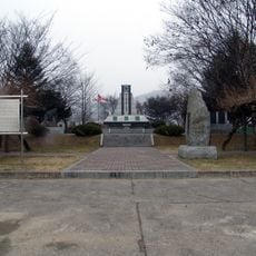
Gapyeong Canada Monument
7.5 km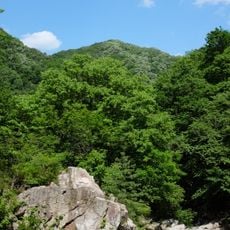
Yeoninsan
3.8 km
Yongchupokpo
3.8 km
Surakpokpo
2.5 km
Suribong
5.3 km
Gitdaebong (tumoy sa bukid sa Habagatang Korea, Gyeonggi-do, lat 37,84, long 127,42)
4.2 km
Maebong
3.1 km
Ongnyŏ-bong (tumoy sa bukid sa Habagatang Korea, Gyeonggi-do)
4 km
Sujeongbong
4.8 km
VenueG Country Club
3.5 km
이재협신도비
8.2 km
HUE Course
3.8 km
Sunhill Golf Club
8.5 km
Lee & Lee Country Club
7.1 km
G Course
4 km
Gapyeong Rail Park
8 km
경반사
2.5 km
가평타입캡슐
7.9 km
HILL Course
3.1 km
첼로
8.2 km
가평학도의용대 참전기념비
7.5 km
바르게살자 운동
8.4 km
가평의병삼일운동기념비
7.7 km
대한독립단 도총재 박창호의 묘
6.7 km
느티나무마을 표식
8.3 km
석탑
5 km
가평군민헌장비
7.9 km
감춰진폭포
7.4 kmReviews
Visited this place? Tap the stars to rate it and share your experience / photos with the community! Try now! You can cancel it anytime.
Discover hidden gems everywhere you go!
From secret cafés to breathtaking viewpoints, skip the crowded tourist spots and find places that match your style. Our app makes it easy with voice search, smart filtering, route optimization, and insider tips from travelers worldwide. Download now for the complete mobile experience.

A unique approach to discovering new places❞
— Le Figaro
All the places worth exploring❞
— France Info
A tailor-made excursion in just a few clicks❞
— 20 Minutes