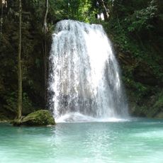
Level 7: Phu Pha Erawan
Location: จังหวัดกาญจนบุรี
GPS coordinates: 14.35927,99.14093
Latest update: November 17, 2025 15:16
Erawan National Park
7.8 km
Wat Tha Kradan
11.1 km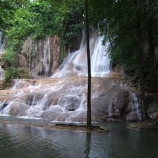
Sai Yok Noi waterfall
16.1 km
Tha Thung Na Dam
17.3 km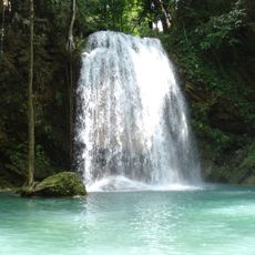
Erawan waterfall
1.9 km
Tha Thung Na Reservoir
15.7 km
Nautiloid Site
10.5 km
Thai song channel
8.2 km
Level 1: Hlai Keun Lung
1.2 km
Level 3: Pha Num Tok
937 m
Level 5: Buar Mai Long
330 m
Level 2: Wung Macha
1 km
Level 6: Dong Prouk Sa
180 m
Erawan Waterfall
1.1 km
Khuean Sinakharin Golf Course
4.1 km
Lawa cave turn off
16.7 km
Nature Interpretive Trail - Not worth the extra way
1 km
Level 4: Oke Nank Phee Seah
816 m
Water Source
15.5 km
แพพลอยพิน
6.7 km
Taweechai Elephant Camp
18.2 km
Scenic viewpoint
938 m
Scenic viewpoint
17.1 km
Scenic viewpoint
18.6 km
Scenic viewpoint
18.5 km
Scenic viewpoint
5.6 km
Giant Sundial
5.1 km
น้ำตกไทรโยคน้อย
16.1 kmReviews
Visited this place? Tap the stars to rate it and share your experience / photos with the community! Try now! You can cancel it anytime.
Discover hidden gems everywhere you go!
From secret cafés to breathtaking viewpoints, skip the crowded tourist spots and find places that match your style. Our app makes it easy with voice search, smart filtering, route optimization, and insider tips from travelers worldwide. Download now for the complete mobile experience.

A unique approach to discovering new places❞
— Le Figaro
All the places worth exploring❞
— France Info
A tailor-made excursion in just a few clicks❞
— 20 Minutes