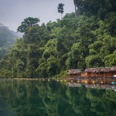
Sip et Chang
Location: จังหวัดสุราษฎร์ธานี
GPS coordinates: 8.94452,98.52689
Latest update: November 20, 2025 11:37
Khao Sok
951 m
Wat Tham Phanthurat
4.9 km
Elephant Sanctuary
5.8 km
Tang Nam
5.4 km
Wang Yaow
4.7 km
Bang Liap Nam
4.8 km
Wang Yao
4.7 km
Ton Mai Yai
4.7 km
Monkey watering hole.
4.3 km
Rafflesia way
6.2 km
One of rafflesia's places
6 km
Rope bridge
2.5 km
Rafflesia trail???
7.2 km
Rafflesia 2019 spot
6 km
Wat Tham Panthurat
5 km
Khao Sok National Park
3.3 km
Wang Yao pool
4.8 km
Our Jungle House Beach
4.2 km
Scenic viewpoint
4.9 km
Scenic viewpoint
7.1 km
Scenic viewpoint
5.1 km
Scenic viewpoint
4.1 km
Scenic viewpoint
5.4 km
Tan Sawan
6 km
Ton Kiol Waterfall
5 km
Wing Hin Waterfall
4.3 km
Tiny waterfall
5.7 km
Wing Hin
4.3 kmReviews
Visited this place? Tap the stars to rate it and share your experience / photos with the community! Try now! You can cancel it anytime.
Discover hidden gems everywhere you go!
From secret cafés to breathtaking viewpoints, skip the crowded tourist spots and find places that match your style. Our app makes it easy with voice search, smart filtering, route optimization, and insider tips from travelers worldwide. Download now for the complete mobile experience.

A unique approach to discovering new places❞
— Le Figaro
All the places worth exploring❞
— France Info
A tailor-made excursion in just a few clicks❞
— 20 Minutes