วัดถ้ำมุนีนาถ
Location: จังหวัดกาญจนบุรี
GPS coordinates: 13.96075,99.52622
Latest update: November 18, 2025 06:38
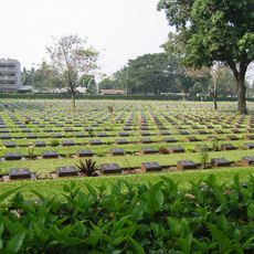
Kanchanaburi War Cemetery
7.9 km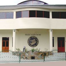
Death Railway Museum and Research Centre
8 km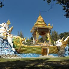
Wat Chaichumphon Chana Songkhram
6.2 km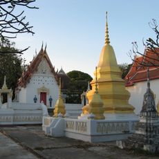
Wat Thewa Sangkharam
7.3 km
Wat Tham Mangkhon Thong
2.9 km
Beata Mundi Regina
7.9 km
Wat Tham Khao Pun
5 km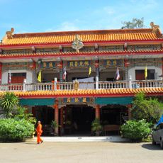
Wat Thawon Wararam
7.5 km
Giant Monkey Pod Tree
633 m
Crystal Cave
6.7 km
Giant rain tree
5.9 km
City gate and wall
6.6 km
City pillar shrine
6.6 km
Giant Monkey Pod Tree
631 m
Heritage Walk
6.8 km
Wat Ban Tham
5.7 km
วัดโพธิสัตว์บรรพตนิมิต
5.9 km
Giant Rain Tree
1.5 km
Lokomotive
8.1 km
West wonder waterpark
7.7 km
Wat Ban Tham
5.6 km
Wat
5.5 km
River and Mountain Viewpoint
4.6 km
Scenic viewpoint
4.8 km
Scenic viewpoint
5.6 km
Memorial
5.1 km
Memorial
5.1 km
Tomb
4.2 kmReviews
Visited this place? Tap the stars to rate it and share your experience / photos with the community! Try now! You can cancel it anytime.
Discover hidden gems everywhere you go!
From secret cafés to breathtaking viewpoints, skip the crowded tourist spots and find places that match your style. Our app makes it easy with voice search, smart filtering, route optimization, and insider tips from travelers worldwide. Download now for the complete mobile experience.

A unique approach to discovering new places❞
— Le Figaro
All the places worth exploring❞
— France Info
A tailor-made excursion in just a few clicks❞
— 20 Minutes