Tam Lod -Thalu Mountain Kayaking
Location: จังหวัดพังงา
Website: https://youtu.be/n-knngi2NO0
Website: https://youtu.be/n-knngi2NO0
GPS coordinates: 8.30057,98.49671
Latest update: November 3, 2025 00:57
Ao Phang-nga National Park
7 km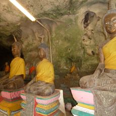
Wat Suwan Khuha
14.5 km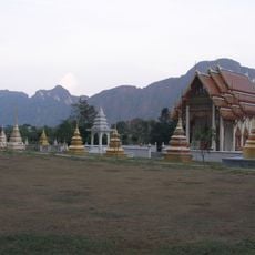
Wat Praphat Prachim Khet
16 km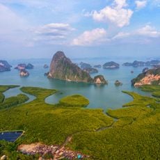
Samet Nang She viewpoint
8.9 km
Khao Khian เขาเขียน
5 km
Peer to Kho Hong and Mangroves
11.6 km
Hong Island kayaking
8.7 km
Fruit garden
10.2 km
Krasom surakul soccer academy
10.9 km
Baan Bang Phat
11 km
Ice Cream Cave
11.1 km
Dairyhut Farm
14.1 km
Nai Ngob Pier
9.9 km
Деревня Цыган
3.8 km
Paddle Rock
5.1 km
Monkey Feeding Area
14.6 km
Monkey Feeding Area
14.5 km
Abbot Statue
14.6 km
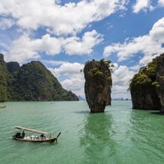
James Bond Island
2.9 km
Kuan Ta Iam - ควนตาเอี่ยม
7.7 km
Toh Li Viewpoint
10.1 km
Samet Nang She Viewpoint
9.4 km
Scenic viewpoint
11.1 km
Scenic viewpoint
15.8 km
Scenic viewpoint
13.7 km
Stone arch
1.9 km
Monument
10.7 km
Monument
12 kmReviews
Visited this place? Tap the stars to rate it and share your experience / photos with the community! Try now! You can cancel it anytime.
Discover hidden gems everywhere you go!
From secret cafés to breathtaking viewpoints, skip the crowded tourist spots and find places that match your style. Our app makes it easy with voice search, smart filtering, route optimization, and insider tips from travelers worldwide. Download now for the complete mobile experience.

A unique approach to discovering new places❞
— Le Figaro
All the places worth exploring❞
— France Info
A tailor-made excursion in just a few clicks❞
— 20 Minutes