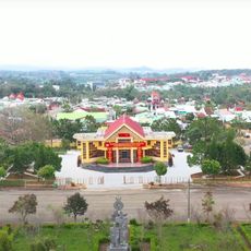
Kon Chu Rang Nature Reserve
Location: Huyện Kon Plông
GPS coordinates: 14.57338,108.44688
Latest update: November 16, 2025 02:42

Măng Đen
17.1 km
Kon Cha Rang
13.5 km
Trai trâu
19.7 km
Hồ Đắk Ke
18.4 km
Thác Pa Sỹ
20.7 km
Nhà Rông Kon Pring
15.8 km
Our Lady of Mang Den
16.4 km
Park and Lake
17.2 km
Beautiful curved pine tree path
15.7 km
Quán Thế Âm Bồ Tát
19.2 km
Arch of Kon Plong Market
17.4 km
Đường nhỏ khó đi
15.7 km
Road Doesn’t End Here! It Connects to Road to Mang Den!
20.3 km
Mountain Viewpoint
22.8 km
Don’t Take the Dirt Road to the Left! Stay on the Main Road!
20.5 km
Road From Dak Lo Connects Here
19 km
Turn Right For Shorter Route to Mang Den
17.6 km
Lang Nghe Kon Nang Nha Rong
17.4 km
View of Dak Nghe River
26.2 km
Great Viewpoint at Sunset
20.1 km
Great Valley Viewpoint at the Vi O Lak Pass
22.4 km
Rest Stop and Valley Viewpoint
22.9 km
Tượng đài Chiến thắng Măng Đen
17.1 km
Tượng Đức Mẹ Măng Đen
16.3 km
Waterfall
6.1 km
Thác K50
18.2 km
Thác Pa Sỹ
20.7 km
Thác Ba Tầng
10.1 kmReviews
Visited this place? Tap the stars to rate it and share your experience / photos with the community! Try now! You can cancel it anytime.
Discover hidden gems everywhere you go!
From secret cafés to breathtaking viewpoints, skip the crowded tourist spots and find places that match your style. Our app makes it easy with voice search, smart filtering, route optimization, and insider tips from travelers worldwide. Download now for the complete mobile experience.

A unique approach to discovering new places❞
— Le Figaro
All the places worth exploring❞
— France Info
A tailor-made excursion in just a few clicks❞
— 20 Minutes