Đàn tế Trời Đất - Tây Sơn
Location: Huyện Tây Sơn
Operator: Sở văn hóa thể thao và du lịch
Address: 19
GPS coordinates: 13.91744,108.86476
Latest update: November 16, 2025 06:48
Thap Banh It
29.2 km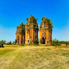
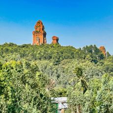
Thap Duong Long
13.6 km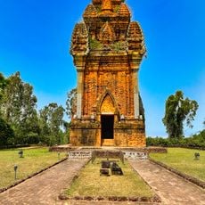
Thap Canh Tien
22.8 km
Dinh Binh Lake
30.2 km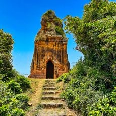
Thap Phu Loc
24.7 km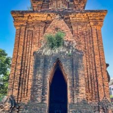
Thap Binh Lam
34.8 km
Mang Yang Pass
37.2 km
View of the Valley and Truong Uc Mountain
35.7 km
Hố Sơn
37.8 km
Song Ba Bridge
23.4 km
Ngã Ba Phú Tài
33.6 km
Khu du lịch Hầm Hô
4.2 km
Recycle Garden
37 km
Hầm Hô
5.1 km
Hòn Chác
30.1 km
Núi Trường Úc
35.2 km
Núi Kỳ Sơn
35.9 km
Hòn Gung
34.4 km
Kon River Viewpoint
14.6 km
Van Phong Dam and Kon River Viewpoint
2.6 km
Nghĩa trang Liệt sĩ Thị trấn Diêu Trì
32.3 km
Buddha statue
30 km
Đài Tưởng Niêm Liệt Sĩ Huyện Phù Mỹ
34.6 km
Hoang De Citadel
22.4 km
Tháp Dương Long
13.6 km
Monument
23.1 km
Monument
24.5 km
Monument
27.7 kmReviews
Visited this place? Tap the stars to rate it and share your experience / photos with the community! Try now! You can cancel it anytime.
Discover hidden gems everywhere you go!
From secret cafés to breathtaking viewpoints, skip the crowded tourist spots and find places that match your style. Our app makes it easy with voice search, smart filtering, route optimization, and insider tips from travelers worldwide. Download now for the complete mobile experience.

A unique approach to discovering new places❞
— Le Figaro
All the places worth exploring❞
— France Info
A tailor-made excursion in just a few clicks❞
— 20 Minutes