Peace Pole
Location: Orange
Location: Orange City Council
GPS coordinates: -33.25564,149.09780
Latest update: November 21, 2025 00:45
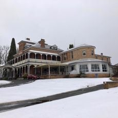
Duntryleague with Lodge, Park, Gates and former Stables, Woodward St, Orange, NSW, Australia
2.8 km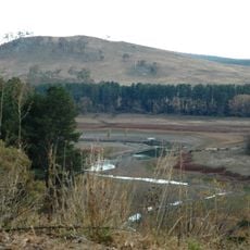
Suma Park Dam
4.5 km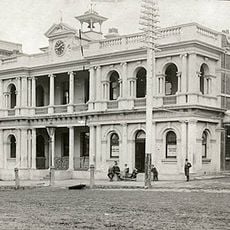
Orange Post Office
3.2 km
Union Bank of Australia building, Orange
2.9 km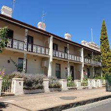
Bowen Terrace
3.4 km
Berrilea
3 km
Uniting Church and Kindergarten Hall, Orange
3 km
Cook Park
3.2 km
Endeavour Park
3.2 km
Tandera Park
3 km
Endeavour Park
3.1 km
Colvin Park
2.9 km
Brendon Sturgeon Oval
1.1 km
Towac Park Racecourse
5.5 km
Wentworth Park
4 km
Moulder Park
3.9 km
Orange Botanic Gardens
146 m
Duntryleague Golf Club
2.8 km
Bloomfield Country Club Golf Course
6.5 km
Wentworth Golf Club Orange
4.7 km
Analemmatic Sundial
127 m
Orange Civic Theatre
2.9 km
Orange Regional Gallery
2.9 km
Work of art, sculpture
3.6 km
Rotary Lookout
3.6 km
Banjo Patterson's Birthplace
3.7 km
Memorial
3.6 km
Cenotaph
3.1 kmReviews
Visited this place? Tap the stars to rate it and share your experience / photos with the community! Try now! You can cancel it anytime.
Discover hidden gems everywhere you go!
From secret cafés to breathtaking viewpoints, skip the crowded tourist spots and find places that match your style. Our app makes it easy with voice search, smart filtering, route optimization, and insider tips from travelers worldwide. Download now for the complete mobile experience.

A unique approach to discovering new places❞
— Le Figaro
All the places worth exploring❞
— France Info
A tailor-made excursion in just a few clicks❞
— 20 Minutes