Feature Wall
Location: Kwolyin
Location: Shire Of Bruce Rock
GPS coordinates: -31.88725,117.70743
Latest update: November 24, 2025 02:01
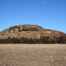
Kokerbin Rock
202 m
Badjaling Nature Reserve
22.2 km
Old Regent Theatre
28 km
Mount Stirling
10.2 km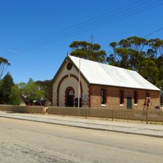
Agricultural Hall, Kellerberrin
28.4 km
Scott Park
28 km
Hillview House Group
28.1 km
Nangeen Hill
6.1 km
Mount Caroline
12.7 km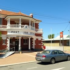
Kellerberrin Post Office & Residence
28.2 km
Olympia Pictures
28.1 km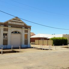
Kellerberrin Fire Station
28.2 km
Dog Rock
348 m
Kellerberrin Hill
29.4 km
Rock Well
698 m
Devil's Marbles
351 m
Lizard Head
204 m
School Site
657 m
Pink Lake of Quairading
21.6 km
Wave Rock
38 m
Smallest Bank
13.2 km
Historic Church
12.1 km
Rabbit Trap Site
25.6 km
Scenic viewpoint
441 m
Scenic viewpoint
309 m
Scenic viewpoint
169 m
Scenic viewpoint
29.3 km
War memorial, memorial
12.9 kmReviews
Visited this place? Tap the stars to rate it and share your experience / photos with the community! Try now! You can cancel it anytime.
Discover hidden gems everywhere you go!
From secret cafés to breathtaking viewpoints, skip the crowded tourist spots and find places that match your style. Our app makes it easy with voice search, smart filtering, route optimization, and insider tips from travelers worldwide. Download now for the complete mobile experience.

A unique approach to discovering new places❞
— Le Figaro
All the places worth exploring❞
— France Info
A tailor-made excursion in just a few clicks❞
— 20 Minutes