Lal Lal Waterfall
Location: Lal Lal
Location: Shire of Moorabool
GPS coordinates: -37.65509,144.03551
Latest update: November 22, 2025 03:51

Kryal Castle
11.6 km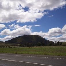
Mount Buninyong
9.8 km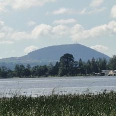
Mount Warrenheip
11.1 km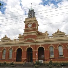
Buninyong Town Hall
13.3 km
Buninyong botanic gardens
13.4 km
Cliff Kennett Park
13.1 km
Buninyong Public Library
13.4 km
Green Hill
12.2 km
Lal Lal Reservoir
2.4 km
Ballantrae
12 km
Lal Lal Iron Mine and Smelting Works
4.3 km
Rothbury
3 km
Rail Bridge and Embankment
7.9 km
Former Brind's Distillery
9.7 km
Portland Flat Road Bridge
11.4 km
Champions Hill
5.3 km
Lal Lal Falls
235 m
Fire Spotting Tower and Public Lookout
9.6 km
Mount Doran
5.9 km
Scenic viewpoint
3.8 km
Moorabool Falls
1.3 km
Granite Falls
1.1 km
Scenic viewpoint
4.2 km
Former Mine Site (Union Jack?)
11.7 km
Goods shed
8.8 km
Granite Falls
1.1 km
Moorabool Falls
1.3 km
Peerewerrh Cascades
7.9 kmReviews
Visited this place? Tap the stars to rate it and share your experience / photos with the community! Try now! You can cancel it anytime.
Discover hidden gems everywhere you go!
From secret cafés to breathtaking viewpoints, skip the crowded tourist spots and find places that match your style. Our app makes it easy with voice search, smart filtering, route optimization, and insider tips from travelers worldwide. Download now for the complete mobile experience.

A unique approach to discovering new places❞
— Le Figaro
All the places worth exploring❞
— France Info
A tailor-made excursion in just a few clicks❞
— 20 Minutes