Aboriginal sacred sites and rock engravings
Location: Laguna
Location: Cessnock City Council
GPS coordinates: -33.11710,151.03530
Latest update: November 21, 2025 06:24
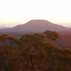
Mount Yengo
22.6 km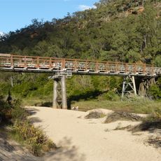
MacDonald River bridge, St Albans
20.6 km
Great North Road
13.8 km
St Barnabas Anglican Church, Yarramalong
25.2 km
Price Morris Cottage
20.3 km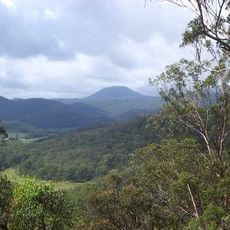
Mount Warrawolong
22.9 km
Kulnura Pioneer Park
21.3 km
N J Kearns Oval
22.5 km
Slack Park
22.6 km
Neill Park
21.3 km
Tom McKenzie Park
26.2 km
McKenzie Park
26.2 km
Mount Mcquoid
9.8 km
Mount Bulgalaben
14.9 km
Aboriginal sacred sites and rock engravings
15.6 km
Thompsons Bridge Convict Trail
13.1 km
Scenic viewpoint
15.8 km
Scenic viewpoint
13.9 km
Finchley Trig Lookout
15.6 km
Flat Rock Lookout
25.5 km
Scenic viewpoint
24.4 km
Scenic viewpoint
22.9 km
Bucketty Wall Precinct
9.4 km
Cannon
27 km
Memorial, war memorial
23.2 km
Monument
22.2 km
Mount Manning Aboriginal Area
7.9 km
Great North Road - Culvert
11.7 kmReviews
Visited this place? Tap the stars to rate it and share your experience / photos with the community! Try now! You can cancel it anytime.
Discover hidden gems everywhere you go!
From secret cafés to breathtaking viewpoints, skip the crowded tourist spots and find places that match your style. Our app makes it easy with voice search, smart filtering, route optimization, and insider tips from travelers worldwide. Download now for the complete mobile experience.

A unique approach to discovering new places❞
— Le Figaro
All the places worth exploring❞
— France Info
A tailor-made excursion in just a few clicks❞
— 20 Minutes