Mount Yengo, Mountain summit in Lower Hunter region, New South Wales, Australia.
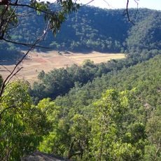
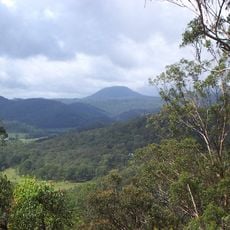
Mount Yengo is a 668-metre summit in the Calore Range, part of the Great Dividing Range, inside Yengo National Park in the Lower Hunter region of New South Wales. Its top is flat, a shape attributed in local Aboriginal narrative to Baiame. The peak lies about 3 kilometres east of the Macdonald River and 17 kilometres east by south of Putty.
Mount Yengo lies within Yengo National Park, declared in 1988 and covering about 150,000 hectares of the Lower Hunter. The park is part of the Greater Blue Mountains World Heritage Area, listed in 2000. Its name comes from the mountain, which the Wonnarua, Awabakal, Worimi and Darkinjung peoples hold as a sacred site.
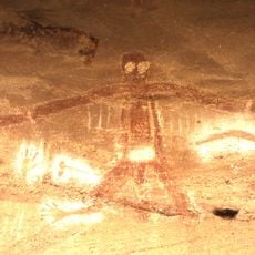
For the Wonnarua, Awabakal, Worimi and Darkinjung peoples, Mount Yengo is a ceremonial site tied to Baiame, the ancestral creator who made the region's mountains, lakes, rivers and caves and then leapt from the peak back to the spirit world. The flat top left by his departure is still pointed out today.
Visitors can reach the summit by following marked walking trails in Yengo National Park, located roughly 200 kilometers northwest of Sydney. It is helpful to check weather and trail conditions before visiting, as circumstances can vary by season.
The flat top is not erosion but the mark of Baiame, the creational ancestral hero of the Wonnarua, Awabakal, Worimi and Darkinjung peoples, who flattened the summit as he jumped skyward back to the spirit world after creating the mountains, lakes, rivers and caves of the area.
The community of curious travelers
AroundUs brings together thousands of curated places, local tips, and hidden gems, enriched daily by 94,046 contributors worldwide.