Pulpit Rock
Location: Green Cape
Location: Bega Valley Shire Council
GPS coordinates: -37.23925,150.03471
Latest update: October 11, 2024 01:36
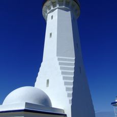
Green Cape Lighthouse
2.8 km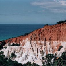
Beowa National Park
7.7 km
Newtons Beach
15.9 km
Green Cape Lighthouse
2.9 km
Jane Spiers Beach
14.2 km
Wonboyn Beach
8 km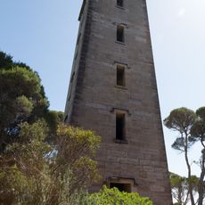
Ben Boyd Tower
16.9 km
Saltwater Creek
8.1 km
Ly-Ee-Moon Memorial
2.9 km
Round Hill Lookout
12.8 km
Imlay brothers house ruins
3.3 km
Wonboyn Beach
7.8 km
Bittangabee Bay Storehouse
3 km
Scenic viewpoint
2.9 km
Saltwater Creek North
8.9 km
1568 Km
10.2 km
Jane Spiers North
11.7 km
Mowarry Point 1
11.7 km
Mowarry Beach
11.8 km
Disaster Bay Lookout
3.6 km
Leather Jacket Bay
13.8 km
Memorial, commemorative plaque
2.9 km
Sea caves
15.2 km
City Rock
2.6 km
Newtons Beach
16.1 km
Red Point Lookout
16.8 km
Boyd's tower
16.8 km
Scenic viewpoint
79 mReviews
Visited this place? Tap the stars to rate it and share your experience / photos with the community! Try now! You can cancel it anytime.
Discover hidden gems everywhere you go!
From secret cafés to breathtaking viewpoints, skip the crowded tourist spots and find places that match your style. Our app makes it easy with voice search, smart filtering, route optimization, and insider tips from travelers worldwide. Download now for the complete mobile experience.

A unique approach to discovering new places❞
— Le Figaro
All the places worth exploring❞
— France Info
A tailor-made excursion in just a few clicks❞
— 20 Minutes